|
search place name
|
||
Namadīneh (Kordestān, Iran)Namadīneh is a town in the Kordestān region of Iran. An overview map of the region around Namadīneh is displayed below.
regional and 3d topo map of Namadīneh, Iran ::

Namadīneh airports ::
The nearest airport is SDG - Sanandaj, located 128.1 km south of Namadīneh.
Other airports nearby include TBZ - Tabriz Intl (201.6 km north), KSH - Bakhtaran Shahid Ashrafi Esfahani (227.7 km south), Nearby towns ::
Kīleh Kabūd (1.5km west) //
Seyyedābād (1.5km east) //
Qal'eh Kohneh (4.5km south) //
Qeshlāq Reẕā (4.8km east) //
Ḩasanābād-e Qāshoq (5.8km north) //
Yāzī Bolāghī (4.8km east) //
Yāpesh Khān (5.8km south east) //
Qāshoq (7.4km north) //
Yamīnābād (7.4km north) //
‘Alīābād (7.6km south) //
Pacheh Sūr (7.1km north east) //
Zolfīneh (8.0km north) //
Khūsheh Darreh (7.6km north east) //
Chāgherlū (7.8km south east) //
Chīchīkhavār (8.7km south east) //
Qal‘ehgāh-e Gūdarz (8.2km north west) //
Legzī (8.2km south west) //
Qūrkhān (8.7km north east) //
Qalandar (9.5km north west) //
[all distances 'as the bird flies' and approximate] 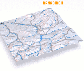 Places with similar names to Namadīneh, Iran ::
Disclaimer :: Information on this page comes without warranty of any kind |
||
|
Where is Namadīneh? Elevation and coordinates ::
Latitude (lat): 36°20'0"N Longitude (lon): 46°32'0"E
Elevation (approx.): 1404m (map arrows pan, magnifying glasses zoom) |
||
|
Visiting Namadīneh? Hotel/Accommodation ::
Book a hotel in Namadīneh Travel Guide ::
Buy a travel guide for Iran rental cars ::
car rental offers GPS waypoint ::
download a GPX waypoint (PoI) of Namadīneh for your GPS receiver
|
||