|
search place name
|
||
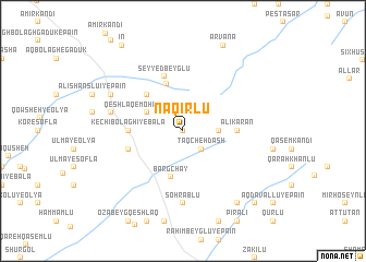
Naqīrlū (Iran)Naqīrlū is a town in Iran. An overview map of the region around Naqīrlū is displayed below.
regional and 3d topo map of Naqīrlū, Iran ::
Naqīrlū airports ::
The nearest airport is TBZ - Tabriz Intl, located 175.3 km west of Naqīrlū.
Other airports nearby include RAS - Rasht (207.0 km south east), BAK - Baku Heydar Aliyev (254.5 km north east), Nearby towns ::
Moḩammadlū (0.0km north) //
Ţāqcheh Dāsh (2.4km south east) //
Jajahlū (2.9km east) //
Qeshlāq-e Moḩammad Qolī (3.4km north west) //
Bargchāy (4.8km south) //
Seyyed Lar (5.0km north) //
Sobḩānlū (4.7km north west) //
Kechī Bolāghī-ye Bālā (4.3km west) //
‘Alīkarān (4.3km east) //
Seyyed Beyglū (5.7km north) //
Kechī Bolāghī-ye Pā'īn (4.7km south west) //
Sohrāblū (7.4km south) //
Āqā Beyglū (6.1km west) //
‘Alī Shānslū'ī-ye Bālā (6.9km north west) //
Khalīfehlū (8.6km south east) //
Kāz̧emlū (8.6km south east) //
Arvana (9.3km north) //
Karamlū (9.4km south east) //
Īn (10.0km north west) //
[all distances 'as the bird flies' and approximate]  Places with similar names to Naqīrlū, Iran ::
Disclaimer :: Information on this page comes without warranty of any kind |
||
|
Where is Naqīrlū? Elevation and coordinates ::
Latitude (lat): 38°45'0"N Longitude (lon): 48°5'0"E
Elevation (approx.): 1715m (map arrows pan, magnifying glasses zoom) |
||
|
Visiting Naqīrlū? Hotel/Accommodation ::
Book a hotel in Naqīrlū Travel Guide ::
Buy a travel guide for Iran rental cars ::
car rental offers GPS waypoint ::
download a GPX waypoint (PoI) of Naqīrlū for your GPS receiver
|
||