|
search place name
|
||
Nargesī-ye Takht-e Kabūd (Khūzestān, Iran)Nargesī-ye Takht-e Kabūd is a town in the Khūzestān region of Iran. An overview map of the region around Nargesī-ye Takht-e Kabūd is displayed below.
regional and 3d topo map of Nargesī-ye Takht-e Kabūd, Iran ::

Nargesī-ye Takht-e Kabūd airports ::
The nearest airport is QMJ - Masjed Soleiman Shahid Asyaee, located 52.2 km north west of Nargesī-ye Takht-e Kabūd.
Other airports nearby include AWZ - Ahwaz (93.4 km south west), MRX - Bandar Mahshahr Mahshahr (133.1 km south), ABD - Abadan (199.0 km south west), Nearby towns ::
Kal Gah (4.6km north) //
Parahā (4.6km north east) //
Kūj (5.1km north) //
Gowd Nargesī (5.2km south west) //
Gūr-e Khār (6.3km north east) //
Bekāl (7.4km north west) //
Moḩammad Şāleḩ (6.6km east) //
Sar Dellī (6.9km east) //
Cheshmeh ‘Abdollāh (8.1km north) //
Eshkaft-e Bābā Mīr (7.5km north east) //
Bīd Zard (7.2km west) //
Shāhī (8.7km north) //
Chāh Kermak (8.4km north east) //
Pīr Balūt (8.9km south east) //
[all distances 'as the bird flies' and approximate] 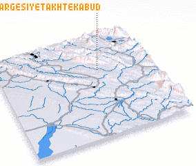 Places with similar names to Nargesī-ye Takht-e Kabūd, Iran :: Disclaimer :: Information on this page comes without warranty of any kind |
||
|
Where is Nargesī-ye Takht-e Kabūd? Elevation and coordinates ::
Latitude (lat): 31°40'21"N Longitude (lon): 49°39'50"E
Elevation (approx.): 1003m (map arrows pan, magnifying glasses zoom) |
||
|
Visiting Nargesī-ye Takht-e Kabūd? Hotel/Accommodation ::
Book a hotel in Nargesī-ye Takht-e Kabūd Travel Guide ::
Buy a travel guide for Iran rental cars ::
car rental offers GPS waypoint ::
download a GPX waypoint (PoI) of Nargesī-ye Takht-e Kabūd for your GPS receiver
|
||