|
search place name
|
||
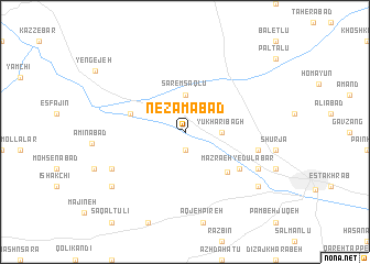
Nez̧āmābād (Iran)Nez̧āmābād is a town in Iran. An overview map of the region around Nez̧āmābād is displayed below.
regional and 3d topo map of Nez̧āmābād, Iran ::
Nez̧āmābād airports ::
The nearest airport is RAS - Rasht, located 129.3 km north east of Nez̧āmābād.
Other airports nearby include SDG - Sanandaj (204.0 km south west), Nearby towns ::
Vālā Rūd (1.9km south) //
Yūkhārī Bāgh (3.0km east) //
Sāremsāqlū (3.7km north) //
Chīyar (4.8km north west) //
Kūshkān (5.3km south east) //
Ḩājjī Aḩmad (5.8km south east) //
Mazra‘eh-ye Dūlābār (5.8km south east) //
Behesht-e Zahrā (6.2km east) //
Mazra‘eh-ye ‘Alīābād (7.0km south east) //
Bāghlūjeh Bayāt (7.0km south west) //
Mazra‘eh-ye Māldarreh (8.1km south east) //
Bāghlūjeh-ye Mehtar (8.1km south west) //
[all distances 'as the bird flies' and approximate] 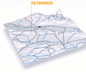 Places with similar names to Nez̧āmābād, Iran ::
Disclaimer :: Information on this page comes without warranty of any kind |
||
|
Where is Nez̧āmābād? Elevation and coordinates ::
Latitude (lat): 36°43'0"N Longitude (lon): 48°22'0"E
Elevation (approx.): 1537m (map arrows pan, magnifying glasses zoom) |
||
|
Visiting Nez̧āmābād? Hotel/Accommodation ::
Book a hotel in Nez̧āmābād Travel Guide ::
Buy a travel guide for Iran rental cars ::
car rental offers GPS waypoint ::
download a GPX waypoint (PoI) of Nez̧āmābād for your GPS receiver
|
||