|
search place name
|
||
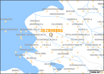
Nez̧āmābād (Ostān-e Āz̄arbāyjān-e Gharbī, Iran)Nez̧āmābād is a town in the Ostān-e Āz̄arbāyjān-e Gharbī region of Iran. An overview map of the region around Nez̧āmābād is displayed below.
regional and 3d topo map of Nez̧āmābād, Iran ::
Nez̧āmābād airports ::
The nearest airport is TBZ - Tabriz Intl, located 121.4 km north of Nez̧āmābād.
Other airports nearby include SDG - Sanandaj (224.0 km south east), Nearby towns ::
Ḩājjī Ḩasan-e Khāleşeh (1.5km east) //
Morādkhānlū (2.4km north west) //
Kord Kandī (2.4km north east) //
Tāzeh Kand-e Lalaklū (2.4km south west) //
Ḩājjī Ḩasan-e Soflá (3.0km east) //
Moşţafá Kandī (3.5km south west) //
Eslāmābād (4.0km north) //
Lalaklū (4.0km south) //
Fīrūzābād (3.5km north east) //
Ḩājjī Ḩasan-e Bālā (3.5km south east) //
Chahār Borj-e Jadīd (4.7km north east) //
Ḩāşel Qū'ī-ye Afshār (4.7km south east) //
Malekābād (4.8km south west) //
Dāsh Tappeh (5.6km south) //
Ja‘farābād-eChelīk (4.4km west) //
Javād Ḩeşārī (4.7km east) //
Chelīk (4.8km north west) //
Shakūr Kandī (4.8km south west) //
Qareh Gowzlū (5.8km north west) //
Yārījān-e Soflá (5.8km south east) //
Yārījān-e ‘Olyā (5.8km south east) //
Tāzeh Kand-e Ḩāşel Qū'ī (6.3km south east) //
Marvān Kandī (5.8km south west) //
Chahār Borj-e Qadīm (6.5km north east) //
Ebrāhīm Ḩeşārī (7.6km north) //
Yārījān-e Khāleşeh (6.2km east) //
Ḩāşel Qū'ī-ye Amīrābād (7.1km south east) //
Gerdeh Rash (7.1km south west) //
Fesendūz (7.0km north west) //
[all distances 'as the bird flies' and approximate]  Places with similar names to Nez̧āmābād, Iran ::
Disclaimer :: Information on this page comes without warranty of any kind |
||
|
Where is Nez̧āmābād? Elevation and coordinates ::
Latitude (lat): 37°4'0"N Longitude (lon): 45°56'0"E
Elevation (approx.): 1279m (map arrows pan, magnifying glasses zoom) |
||
|
Visiting Nez̧āmābād? Hotel/Accommodation ::
Book a hotel in Nez̧āmābād Travel Guide ::
Buy a travel guide for Iran rental cars ::
car rental offers GPS waypoint ::
download a GPX waypoint (PoI) of Nez̧āmābād for your GPS receiver
|
||