|
search place name
|
||
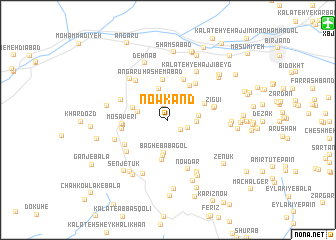
Nowkand (Khorāsān, Iran)Nowkand is a town in the Khorāsān region of Iran. An overview map of the region around Nowkand is displayed below.
regional and 3d topo map of Nowkand, Iran ::
Nowkand airports ::
The nearest airport is XBJ - Birjand, located 18.5 km north east of Nowkand.
Nearby towns ::
Kalāteh-ye Bālā (1.7km north) //
Gīvak-e Pā'īn (1.6km south east) //
Tak-e Sīfī (2.0km south east) //
Qanātū (2.4km north) //
Kalāteh-ye Qannādān (2.5km north) //
Gazak (2.7km east) //
Rekāt-e Bālā (2.9km west) //
Gīvak-e Bālā (3.0km east) //
Zeynī (3.6km north) //
Bāgh-e Bābā Gol (3.8km south) //
Qaşabeh (4.1km south) //
Rekāt-e Pā'īn (3.5km west) //
Qoţbī (3.9km north east) //
Menjegān (4.3km north east) //
Kalāteh-ye Kashbān (4.5km south) //
Hāshemābād (4.5km north) //
Mesgar (4.7km north) //
Ḩasanābād (4.3km west) //
Mosāverī (4.3km west) //
Nārmenj (4.8km north east) //
Gūbgān (4.4km west) //
Zīgū'ī (4.6km east) //
Sorkhāb (4.7km east) //
‘Alīshāh (4.7km east) //
Tangal-e ‘Alī Beyk (4.9km south west) //
Tak-e Kīseh (5.3km north west) //
Khar Poshteh (5.0km north west) //
Ḩalvā'ī (5.3km south west) //
Nowdar (5.8km south) //
[all distances 'as the bird flies' and approximate]  Places with similar names to Nowkand, Iran ::
Disclaimer :: Information on this page comes without warranty of any kind |
||
|
Where is Nowkand? Elevation and coordinates ::
Latitude (lat): 32°48'7"N Longitude (lon): 59°6'16"E
Elevation (approx.): 1838m (map arrows pan, magnifying glasses zoom) |
||
|
Visiting Nowkand? Hotel/Accommodation ::
Book a hotel in Nowkand Travel Guide ::
Buy a travel guide for Iran rental cars ::
car rental offers GPS waypoint ::
download a GPX waypoint (PoI) of Nowkand for your GPS receiver
|
||