|
search place name
|
||
Nūkān (Ostān-e Kermānshāh, Iran)Nūkān is a town in the Ostān-e Kermānshāh region of Iran. An overview map of the region around Nūkān is displayed below.
regional and 3d topo map of Nūkān, Iran ::

Nūkān airports ::
The nearest airport is KSH - Bakhtaran Shahid Ashrafi Esfahani, located 2.2 km south west of Nūkān.
Other airports nearby include SDG - Sanandaj (99.2 km north), Nearby towns ::
Deh Pahn (2.0km south west) //
Ḩeşār-e Sefīd (3.3km south) //
Mānag Halāt (3.5km north) //
Sīāh Bīd-e ‘Olyā (3.7km south east) //
Morādābād (4.1km south) //
Choqā Kalān (3.7km south west) //
Sīāh Bīd-e Soflá (4.0km south east) //
Ţāq-e Bostān (4.3km north west) //
Morād Ḩāşel (4.2km north west) //
Bījāneh (5.4km south west) //
Tāzehābād (5.5km north west) //
Manūchehrābād (6.0km south west) //
Ţāvīleh (6.5km north west) //
Tūbreh Rīz (6.6km south) //
Gākīyeh (6.2km south east) //
Shāţerābād (5.7km west) //
Qīyah (7.6km north) //
Choqā Kabūd (6.4km west) //
Fīrūzābād (6.5km west) //
Balīn (8.0km north) //
Kahrīz (7.5km south west) //
Sorkheh Lījeh (6.9km north west) //
Mūrīān (9.0km south) //
Shūrābeh (9.1km south) //
Kabūdeh-ye Soflá (9.7km south west) //
Bozgodār-e ‘Olyā (10.0km south east) //
[all distances 'as the bird flies' and approximate] 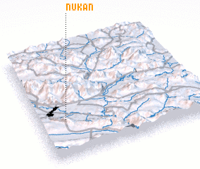 Places with similar names to Nūkān, Iran ::
Disclaimer :: Information on this page comes without warranty of any kind |
||
|
Where is Nūkān? Elevation and coordinates ::
Latitude (lat): 34°21'44"N Longitude (lon): 47°10'20"E
Elevation (approx.): 1326m (map arrows pan, magnifying glasses zoom) |
||
|
Visiting Nūkān? Hotel/Accommodation ::
Book a hotel in Nūkān Travel Guide ::
Buy a travel guide for Iran rental cars ::
car rental offers GPS waypoint ::
download a GPX waypoint (PoI) of Nūkān for your GPS receiver
|
||