|
search place name
|
||
Omīdābād (Eşfahān, Iran)Omīdābād is a town in the Eşfahān region of Iran. An overview map of the region around Omīdābād is displayed below.
regional and 3d topo map of Omīdābād, Iran ::
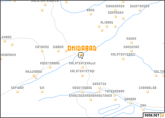
Nearby towns ::
Kalāteh-ye Ḩājjī (1.9km south) //
Kalāteh-ye Taqī (3.7km south) //
Maḩmūdābād (3.5km north west) //
Sīb Bon (4.9km west) //
Ḩājjīābād (7.4km south) //
Ḩoseynābād (7.4km south) //
Dashtgū (7.2km south east) //
Gandalābād (6.3km west) //
Ḩoseynābād (6.3km west) //
Agareh (7.4km north east) //
Palang Darreh (8.0km north) //
Deh Khodā (8.0km south) //
‘Alīābād (8.7km north east) //
‘Abbāsābād (9.5km north east) //
Ḩoseynābād (9.5km north east) //
Tū-ye Darbār (10.0km south east) //
[all distances 'as the bird flies' and approximate] 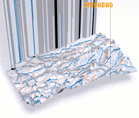
Disclaimer :: Information on this page comes without warranty of any kind |
||
|
Where is Omīdābād? Elevation and coordinates ::
Latitude (lat): 36°6'0"N Longitude (lon): 53°48'0"E
Elevation (approx.): 1799m (map arrows pan, magnifying glasses zoom) |
||
|
Visiting Omīdābād? Hotel/Accommodation ::
Book a hotel in Omīdābād Travel Guide ::
Buy a travel guide for Iran rental cars ::
car rental offers GPS waypoint ::
download a GPX waypoint (PoI) of Omīdābād for your GPS receiver
|
||