|
search place name
|
||
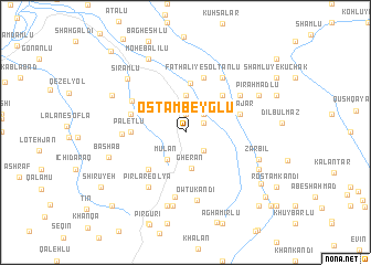
Ostāmbeyglū (Iran)Ostāmbeyglū is a town in Iran. An overview map of the region around Ostāmbeyglū is displayed below.
regional and 3d topo map of Ostāmbeyglū, Iran ::
Ostāmbeyglū airports ::
The nearest airport is TBZ - Tabriz Intl, located 136.3 km south west of Ostāmbeyglū.
Nearby towns ::
Sheykhlū (1.9km north) //
Dāsh Bāshi (1.7km north east) //
Qayah Bāshī-ye Bozorg (2.3km north east) //
Moḩammad Ḩasanlū (2.3km south east) //
Mūlān (3.1km south west) //
Owlī Qeshlāq (3.7km north) //
Gherān (3.7km south) //
Khān Bāghī (5.0km north) //
Asbhār-e Qeshlāq-e Pā'īn (4.7km north east) //
‘Omrānābād (4.7km south west) //
Pāletlū (4.3km west) //
Fatḩ‘alī-ye Solţānlū (5.7km north) //
Sūrājar (4.7km north east) //
Khāngāh Ojāq (4.7km north west) //
Peldersī (5.2km north west) //
Ghenānlū (5.0km west) //
‘Abd ol Razzāq (6.6km south) //
Asbhār-e Bālā (5.7km north east) //
Bālā Beyglū (6.3km north east) //
Pīrlar-e ‘Olyā (6.3km south west) //
Pīrlar-e Soflá (6.3km south west) //
Owtū Kandī (6.9km south) //
Qalyānsāz (7.4km south) //
Tappeh Īshī Bālā (7.6km south) //
Zarbīl (6.4km south east) //
Sīrāmlū (7.1km north west) //
Bashāb (6.6km south west) //
Pīr Aḩmadlū (6.8km north east) //
Sheykhlān-e Soflá (6.8km south east) //
[all distances 'as the bird flies' and approximate] 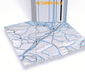 Places with similar names to Ostāmbeyglū, Iran :: Disclaimer :: Information on this page comes without warranty of any kind |
||
|
Where is Ostāmbeyglū? Elevation and coordinates ::
Latitude (lat): 39°6'0"N Longitude (lon): 47°12'0"E
Elevation (approx.): 707m (map arrows pan, magnifying glasses zoom) |
||
|
Visiting Ostāmbeyglū? Hotel/Accommodation ::
Book a hotel in Ostāmbeyglū Travel Guide ::
Buy a travel guide for Iran rental cars ::
car rental offers GPS waypoint ::
download a GPX waypoint (PoI) of Ostāmbeyglū for your GPS receiver
|
||