|
search place name
|
||
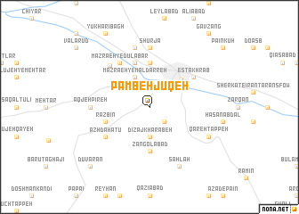
Pāmbeh Jūqeh (Iran)Pāmbeh Jūqeh is a town in Iran. An overview map of the region around Pāmbeh Jūqeh is displayed below.
regional and 3d topo map of Pāmbeh Jūqeh, Iran ::
Pāmbeh Jūqeh airports ::
The nearest airport is RAS - Rasht, located 128.4 km north east of Pāmbeh Jūqeh.
Other airports nearby include SDG - Sanandaj (201.5 km south west), Nearby towns ::
Salmānlū (2.4km south east) //
Dīzaj Kharābeh (3.7km south) //
Mazra‘eh-ye Māldarreh (4.0km north) //
Zanjān (4.7km north east) //
Zangolābād (5.6km south) //
Ḩoseynābād (5.6km north) //
Shūrjeh-ye Dabbāghhā (5.6km north) //
Rāzbīn (4.8km south west) //
Mazra‘eh-ye ‘Alīābād (5.8km north) //
Azhdahātū (5.8km south west) //
Ḩājjī Aḩmad (6.3km north west) //
Mazra‘eh-ye Dūlābār (6.3km north west) //
Estakhr Āb (5.8km north east) //
Kūshkān (6.5km north west) //
Shūrjā (7.4km north) //
Āqjeh Pīreh (5.9km west) //
Behesht-e Zahrā (7.6km north) //
Sahlah (8.0km south) //
Qareh Tappeh (7.0km south east) //
Dūvarān (9.5km south west) //
[all distances 'as the bird flies' and approximate] 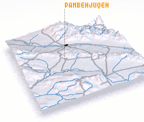 Places with similar names to Pāmbeh Jūqeh, Iran ::
Disclaimer :: Information on this page comes without warranty of any kind |
||
|
Where is Pāmbeh Jūqeh? Elevation and coordinates ::
Latitude (lat): 36°38'0"N Longitude (lon): 48°27'0"E
Elevation (approx.): 1689m (map arrows pan, magnifying glasses zoom) |
||
|
Visiting Pāmbeh Jūqeh? Hotel/Accommodation ::
Book a hotel in Pāmbeh Jūqeh Travel Guide ::
Buy a travel guide for Iran rental cars ::
car rental offers GPS waypoint ::
download a GPX waypoint (PoI) of Pāmbeh Jūqeh for your GPS receiver
|
||