|
search place name
|
||
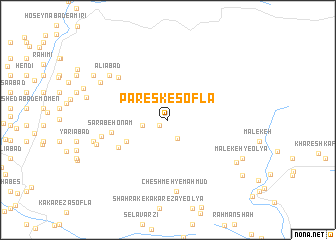
Paresk-e Soflá (Lorestān, Iran)Paresk-e Soflá is a town in the Lorestān region of Iran. An overview map of the region around Paresk-e Soflá is displayed below.
regional and 3d topo map of Paresk-e Soflá, Iran ::
Paresk-e Soflá airports ::
The nearest airport is KSH - Bakhtaran Shahid Ashrafi Esfahani, located 126.5 km north west of Paresk-e Soflá.
Other airports nearby include SDG - Sanandaj (201.7 km north west), QMJ - Masjed Soleiman Shahid Asyaee (218.5 km south east), Nearby towns ::
Peresk (1.0km south west) //
Espesh (2.3km south east) //
Khosrowābād (2.4km west) //
Barāftāb Derāz (4.6km south west) //
Lamdar (5.5km south west) //
Sarāb-e Honām (5.4km west) //
Razīābād (6.6km north west) //
Chahār Takhteh (6.4km west) //
Cheshmeh-ye Maḩmūd (8.0km south) //
‘Alīābād (7.4km north west) //
Ja‘farābād (7.2km south west) //
Ḩeydarābād-e Cheshmeh Barqī (7.5km north west) //
Jahānābād (7.4km west) //
Bard Bal (7.4km west) //
Sarāb Narm-e Soflá (7.9km south east) //
Malekeh-ye ‘Olyā (8.1km south east) //
Darvīshābād (8.5km north west) //
Ḩeydarābād-e Sākī (8.5km north west) //
‘Abbāsābād (8.5km north west) //
Sarāb-e Nūrkar (9.2km south east) //
[all distances 'as the bird flies' and approximate]  Places with similar names to Paresk-e Soflá, Iran :: Disclaimer :: Information on this page comes without warranty of any kind |
||
|
Where is Paresk-e Soflá? Elevation and coordinates ::
Latitude (lat): 33°49'19"N Longitude (lon): 48°22'31"E
Elevation (approx.): 1882m (map arrows pan, magnifying glasses zoom) |
||
|
Visiting Paresk-e Soflá? Hotel/Accommodation ::
Book a hotel in Paresk-e Soflá Travel Guide ::
Buy a travel guide for Iran rental cars ::
car rental offers GPS waypoint ::
download a GPX waypoint (PoI) of Paresk-e Soflá for your GPS receiver
|
||