|
search place name
|
||
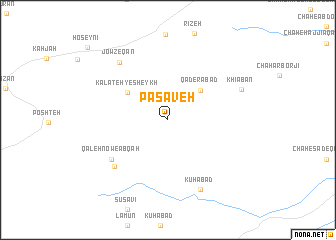
Pasāveh (Khorāsān, Iran)Pasāveh is a town in the Khorāsān region of Iran. An overview map of the region around Pasāveh is displayed below.
regional and 3d topo map of Pasāveh, Iran ::
Pasāveh airports ::
The nearest airport is HEA - Herat, located 167.4 km east of Pasāveh.
Other airports nearby include XBJ - Birjand (231.1 km south west), Nearby towns ::
Qāderābād (4.4km north east) //
Kalāteh-ye Sheykh (4.8km north west) //
Qal‘eh Now-e Ābqah (6.8km south west) //
Ābqah (7.2km south west) //
Jowzeqān (7.8km north west) //
Kūhābād (8.4km south) //
Khīābān (7.6km north east) //
[all distances 'as the bird flies' and approximate] 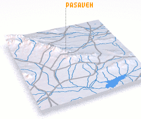 Places with similar names to Pasāveh, Iran ::
Disclaimer :: Information on this page comes without warranty of any kind |
||
|
Where is Pasāveh? Elevation and coordinates ::
Latitude (lat): 34°42'22"N Longitude (lon): 60°30'26"E
Elevation (approx.): 1141m (map arrows pan, magnifying glasses zoom) |
||
|
Visiting Pasāveh? Hotel/Accommodation ::
Book a hotel in Pasāveh Travel Guide ::
Buy a travel guide for Iran rental cars ::
car rental offers GPS waypoint ::
download a GPX waypoint (PoI) of Pasāveh for your GPS receiver
|
||