|
search place name
|
||
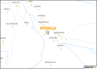
Pīr Ḩājjī (Kermān, Iran)Pīr Ḩājjī is a town in the Kermān region of Iran. An overview map of the region around Pīr Ḩājjī is displayed below.
regional and 3d topo map of Pīr Ḩājjī, Iran ::
Pīr Ḩājjī airports ::
The nearest airport is BND - Bandar Abbass Intl, located 176.8 km west of Pīr Ḩājjī.
Other airports nearby include KHS - Khasab (249.4 km south west), Nearby towns ::
Tombot (1.6km west) //
Deh Gowd (3.0km south east) //
Ḩoseynābād-e Yāraḩmadī (3.3km east) //
Tom-e Sorkh (4.1km north west) //
Chehel Manī (3.9km west) //
‘Abbāsābād (3.8km east) //
Kahūr Derāz (4.7km east) //
Rīgābād (6.6km north) //
Chāh-e Naşīr (6.3km north west) //
Sūrakābād (6.3km east) //
Rīgmatī (7.0km south east) //
Gojg (8.1km north west) //
[all distances 'as the bird flies' and approximate] 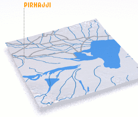 Places with similar names to Pīr Ḩājjī, Iran ::
// Pri Háji (CZ)
Disclaimer :: Information on this page comes without warranty of any kind |
||
|
Where is Pīr Ḩājjī? Elevation and coordinates ::
Latitude (lat): 27°42'0"N Longitude (lon): 58°5'0"E
Elevation (approx.): 416m (map arrows pan, magnifying glasses zoom) |
||
|
Visiting Pīr Ḩājjī? Hotel/Accommodation ::
Book a hotel in Pīr Ḩājjī Travel Guide ::
Buy a travel guide for Iran rental cars ::
car rental offers GPS waypoint ::
download a GPX waypoint (PoI) of Pīr Ḩājjī for your GPS receiver
|
||