|
search place name
|
||
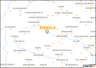
Pīshīklū (Ostān-e Āz̄arbāyjān-e Sharqī, Iran)Pīshīklū is a town in the Ostān-e Āz̄arbāyjān-e Sharqī region of Iran. An overview map of the region around Pīshīklū is displayed below.
regional and 3d topo map of Pīshīklū, Iran ::
Pīshīklū airports ::
The nearest airport is TBZ - Tabriz Intl, located 60.4 km north west of Pīshīklū.
Nearby towns ::
Qāzān Chāy (1.9km north) //
Amrollāh (3.5km north east) //
Heykalābād (4.0km south) //
Gol Ākher (4.6km south east) //
Āqbolāgh (4.7km north west) //
Bahādor (4.4km east) //
Ālmālū (5.6km south) //
Qaţūr Dāghī (4.8km south east) //
Darreh Kand (5.8km north west) //
Āyqer Chaman-e Soflá (6.3km north west) //
Qūrqochī Rūd (5.8km south east) //
Ābdār (7.0km south west) //
Khātūnābād (7.4km north) //
Ḩasan Kohal (5.9km east) //
Eslāmābād (7.6km north) //
Dalī Qūrūqchī (7.6km south) //
Ḩeşār (8.0km north) //
Āyqer Chaman-e ‘Olyā (8.6km north west) //
Majīdābād (8.6km south west) //
Solţān Kandī (8.6km south east) //
Qareh Chāy-e Ḩājjī ‘Alī (8.6km south east) //
Tanūr Āghāj (9.5km north east) //
[all distances 'as the bird flies' and approximate]  Places with similar names to Pīshīklū, Iran ::
// Pashkul (BG)
// Pāchh Kalia (BD)
// Pichicolo (CL)
// Pichiquil (GT)
// Pichukoli (IN)
// Pachuguilla (MX)
// Pachuquilla (MX)
// Pachuquilla (MX)
// Pachuquilla (MX)
// Pechiquil (MX)
Disclaimer :: Information on this page comes without warranty of any kind |
||
|
Where is Pīshīklū? Elevation and coordinates ::
Latitude (lat): 37°42'0"N Longitude (lon): 46°39'0"E
Elevation (approx.): 2141m (map arrows pan, magnifying glasses zoom) |
||
|
Visiting Pīshīklū? Hotel/Accommodation ::
Book a hotel in Pīshīklū Travel Guide ::
Buy a travel guide for Iran rental cars ::
car rental offers GPS waypoint ::
download a GPX waypoint (PoI) of Pīshīklū for your GPS receiver
|
||