|
search place name
|
||
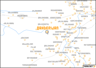
Qahderījān (Eşfahān, Iran)Qahderījān is a town in the Eşfahān region of Iran. An overview map of the region around Qahderījān is displayed below.
regional and 3d topo map of Qahderījān, Iran ::
Nearby towns ::
Mūsīān (2.9km south east) //
Qal'eh Sefīd (3.3km north west) //
Jūjīl (3.3km south east) //
Mīān Rashīd (3.6km south east) //
Karsang (4.6km north) //
Kāh Fashān (4.1km east) //
Nahr-e Khānī (4.3km north west) //
Gārmāseh (5.2km south east) //
Qal‘eh-e Mīr (5.6km south) //
Zāzerān (5.0km north east) //
Shervehdān (5.3km south east) //
Korūj (5.5km south east) //
Qal‘eh Shāh (5.8km north) //
Kahrīz Sang (6.1km north east) //
Felāvarjān (5.6km south east) //
Rīā Khān (5.7km east) //
Esfahrān (6.9km south) //
Dashtchī (6.1km east) //
Bondārt (7.0km south) //
Dasht Lū (6.8km south east) //
Jalālābād (6.5km north east) //
Hūyyeh (6.4km east) //
Dār Afshān (7.6km south east) //
Bābā ‘Abdollāh (7.1km east) //
Fīlūr (7.8km south west) //
Ja‘farābād (7.2km south east) //
Bāgh-e Vaḩsh (8.4km south) //
Mūsīān (7.3km east) //
Velāshān (7.6km east) //
[all distances 'as the bird flies' and approximate] 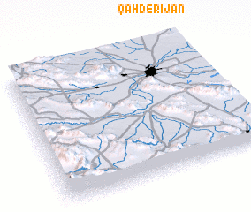 Places with similar names to Qahderījān, Iran ::
// Katargin (RU)
// Kot Rajāna (PK)
Disclaimer :: Information on this page comes without warranty of any kind |
||
|
Where is Qahderījān? Elevation and coordinates ::
Latitude (lat): 32°34'36"N Longitude (lon): 51°27'18"E
Elevation (approx.): 1614m (map arrows pan, magnifying glasses zoom) |
||
|
Visiting Qahderījān? Hotel/Accommodation ::
Book a hotel in Qahderījān Travel Guide ::
Buy a travel guide for Iran rental cars ::
car rental offers GPS waypoint ::
download a GPX waypoint (PoI) of Qahderījān for your GPS receiver
|
||