|
search place name
|
||
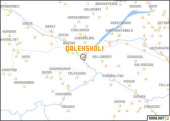
Qal‘eh Sholī (Ostān-e Kohgīlūyeh va Būyer Aḩmad, Iran)Qal‘eh Sholī is a town in the Ostān-e Kohgīlūyeh va Būyer Aḩmad region of Iran. An overview map of the region around Qal‘eh Sholī is displayed below.
regional and 3d topo map of Qal‘eh Sholī, Iran ::
Qal‘eh Sholī airports ::
The nearest airport is BUZ - Bushehr, located 155.1 km south of Qal‘eh Sholī.
Other airports nearby include SYZ - Shiraz Shahid Dastghaib Intl (155.8 km south east), QMJ - Masjed Soleiman Shahid Asyaee (265.8 km north west), Nearby towns ::
Bīdastān (1.3km south east) //
Shūsht-e Bālā (1.9km north) //
Deh Kond (2.4km north west) //
Shūsht-e Pā'īn (2.9km north west) //
Mollā Barfī (3.2km east) //
Kūpon-e Bālā (3.5km north east) //
Cham Bolbol (4.0km north) //
Tol-e Kūshk (4.0km south west) //
Būstān-e Kūchek (3.7km north west) //
Cham Espīd (4.5km south) //
Būstān (4.3km north west) //
Talkh Āb (4.1km east) //
Bīdastān (4.7km south) //
Līrāb (5.6km north) //
Chālmūreh (5.9km north) //
Ghūrak-e Pā'īn (5.5km south west) //
Ālākān (5.9km north west) //
Kovīn-e Vasaţ (5.8km north east) //
Kūpon-e Mīānī (5.9km north east) //
Ghūrak-e Bālā (6.1km south west) //
Khanīmeh-ye Pā'īn (6.1km north east) //
Ḥājjī Qalandar (6.4km south west) //
Kateh (6.3km north west) //
Darreh Darreh (6.7km south west) //
Cham Khūn (6.9km south west) //
Delī-ye Na‘l-e Kūchek (6.4km east) //
Chambalītak (6.8km south east) //
Morāskhūn-e Pā'īn (7.7km north) //
Cham Espīd (7.2km south east) //
[all distances 'as the bird flies' and approximate]  Places with similar names to Qal‘eh Sholī, Iran ::
// Kylychly (AZ)
// Kylyshly (AZ)
// Gulls Hollow (US)
// Kolyshley (RU)
// Kolyshley (RU)
// Gallows Hill (US)
// Gallows Hill (US)
// Coles Hill (US)
// Kolachel (IN)
// Klychli (UZ)
Disclaimer :: Information on this page comes without warranty of any kind |
||
|
Where is Qal‘eh Sholī? Elevation and coordinates ::
Latitude (lat): 30°18'0"N Longitude (lon): 51°14'0"E
Elevation (approx.): 746m (map arrows pan, magnifying glasses zoom) |
||
|
Visiting Qal‘eh Sholī? Hotel/Accommodation ::
Book a hotel in Qal‘eh Sholī Travel Guide ::
Buy a travel guide for Iran rental cars ::
car rental offers GPS waypoint ::
download a GPX waypoint (PoI) of Qal‘eh Sholī for your GPS receiver
|
||