|
search place name
|
||
Qal‘eh-ye Dārāb (Fārs, Iran)Qal‘eh-ye Dārāb is a town in the Fārs region of Iran. An overview map of the region around Qal‘eh-ye Dārāb is displayed below.
regional and 3d topo map of Qal‘eh-ye Dārāb, Iran ::

Qal‘eh-ye Dārāb airports ::
The nearest airport is SYZ - Shiraz Shahid Dastghaib Intl, located 121.6 km south of Qal‘eh-ye Dārāb.
Other airports nearby include AZD - Yazd Shahid Sadooghi (192.0 km north east), Nearby towns ::
Qal‘eh-ye Mīrzā (0.4km south west) //
Qal‘eh-ye Qolī ‘Emādī (1.2km west) //
Qal‘eh-ye Qolī ‘Emādī (1.2km west) //
Maḩmūdābād (2.1km north) //
Ḩeydarābād (2.0km north west) //
Qal‘eh-ye Moqām (2.3km north west) //
Qal‘eh-ye Lāy Mardān (2.7km north west) //
Qal‘eh-ye Shāhbābā (3.1km north west) //
Esmā‘īlābād (3.1km north west) //
Jalīl (3.7km north) //
Bahek (3.7km north) //
Moshkān (4.4km north) //
Sharafābād (5.3km north west) //
Dalv-e Naz̧ar (5.7km north west) //
Seyyed Aḩmadī (6.1km north west) //
Ḩājjīābād (5.9km north west) //
Qeshlāq (6.2km east) //
Anārak (7.7km north west) //
[all distances 'as the bird flies' and approximate] 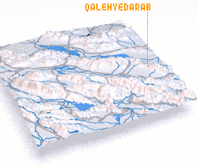 Places with similar names to Qal‘eh-ye Dārāb, Iran :: Disclaimer :: Information on this page comes without warranty of any kind |
||
|
Where is Qal‘eh-ye Dārāb? Elevation and coordinates ::
Latitude (lat): 30°35'3"N Longitude (lon): 52°58'24"E
Elevation (approx.): 2282m (map arrows pan, magnifying glasses zoom) |
||
|
Visiting Qal‘eh-ye Dārāb? Hotel/Accommodation ::
Book a hotel in Qal‘eh-ye Dārāb Travel Guide ::
Buy a travel guide for Iran rental cars ::
car rental offers GPS waypoint ::
download a GPX waypoint (PoI) of Qal‘eh-ye Dārāb for your GPS receiver
|
||