|
search place name
|
||
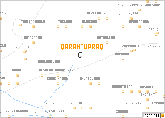
Qarah Tūprāq (Iran)Qarah Tūprāq is a town in Iran. An overview map of the region around Qarah Tūprāq is displayed below.
regional and 3d topo map of Qarah Tūprāq, Iran ::
Qarah Tūprāq airports ::
The nearest airport is THR - Teheran Mehrabad Intl, located 87.8 km east of Qarah Tūprāq.
Other airports nearby include RZR - Ramsar (148.3 km north), RAS - Rasht (202.7 km north), Nearby towns ::
Bāqer Bātān (3.5km south west) //
Īpak (4.5km north west) //
Belaftū (5.8km south) //
Shūr Bolāgh (5.8km south) //
Gūy Bolāgh (5.8km north east) //
Qeshlāq-e Belaftū (6.3km south east) //
Qeshlāq-e Baqar Bātān (5.8km south west) //
Mevījeh Khāk (7.4km north) //
Qānlū Bolāgh (6.3km west) //
‘Alī Akbar (7.6km north) //
Khūrdīkābād (7.2km south west) //
Yek Lang (8.0km north) //
Valīābād (8.7km north west) //
[all distances 'as the bird flies' and approximate] 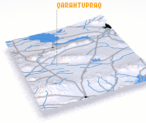 Places with similar names to Qarah Tūprāq, Iran ::
// Karatoprak (TR)
// Karatoprak (TR)
// Garrett Park (US)
// Court Park (US)
// Qareh Towprāq (IR)
// Courida Park (GY)
// Cuero de Puerco (DO)
// Couro de Porco (BR)
Disclaimer :: Information on this page comes without warranty of any kind |
||
|
Where is Qarah Tūprāq? Elevation and coordinates ::
Latitude (lat): 35°36'0"N Longitude (lon): 50°21'0"E
Elevation (approx.): 1600m (map arrows pan, magnifying glasses zoom) |
||
|
Visiting Qarah Tūprāq? Hotel/Accommodation ::
Book a hotel in Qarah Tūprāq Travel Guide ::
Buy a travel guide for Iran rental cars ::
car rental offers GPS waypoint ::
download a GPX waypoint (PoI) of Qarah Tūprāq for your GPS receiver
|
||