|
search place name
|
||
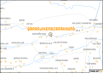
Qaranjīk-e Naz̧ar Ākhūnd (Golestān, Iran)Qaranjīk-e Naz̧ar Ākhūnd is a town in the Golestān region of Iran. An overview map of the region around Qaranjīk-e Naz̧ar Ākhūnd is displayed below.
regional and 3d topo map of Qaranjīk-e Naz̧ar Ākhūnd, Iran ::
Nearby towns ::
Qaranjīk-e Makhtūm Qolī (0.0km north) //
Qaranjīk-e Qorbān Ākhūnd (1.5km east) //
Qareh Jalar (1.5km west) //
Karīm Īshān (1.5km west) //
Qal‘eh-ye Ḩājjī Galdī Khān (1.5km west) //
Arkh-e Bozorg (3.0km west) //
Qareh Chalū (4.0km south) //
Kārkhāneh Āb (3.6km west) //
Eslām Tappeh (4.3km south east) //
Qaranjīk-e Gūgjelī (6.2km south east) //
Şaḩneh-ye Pā'īn (5.5km east) //
Dālī (7.4km south) //
Arkh-e Kūchek (6.3km south west) //
Gomīshlī (7.4km south) //
Qaranjīk (7.1km south east) //
Şaḩneh-ye Bālā (6.4km east) //
Gomīshlī (8.0km south) //
Katūk (7.1km north west) //
Kows̄lar (7.1km north west) //
Āq Qabr (7.4km north east) //
Yāmpī (7.8km south east) //
[all distances 'as the bird flies' and approximate]  Places with similar names to Qaranjīk-e Naz̧ar Ākhūnd, Iran :: Disclaimer :: Information on this page comes without warranty of any kind |
||
|
Where is Qaranjīk-e Naz̧ar Ākhūnd? Elevation and coordinates ::
Latitude (lat): 36°59'0"N Longitude (lon): 54°19'0"E
Elevation (approx.): -18m (map arrows pan, magnifying glasses zoom) |
||
|
Visiting Qaranjīk-e Naz̧ar Ākhūnd? Hotel/Accommodation ::
Book a hotel in Qaranjīk-e Naz̧ar Ākhūnd Travel Guide ::
Buy a travel guide for Iran rental cars ::
car rental offers GPS waypoint ::
download a GPX waypoint (PoI) of Qaranjīk-e Naz̧ar Ākhūnd for your GPS receiver
|
||