|
search place name
|
||
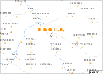
Qareh Bāţlāq (Iran)Qareh Bāţlāq is a town in Iran. An overview map of the region around Qareh Bāţlāq is displayed below.
regional and 3d topo map of Qareh Bāţlāq, Iran ::
Qareh Bāţlāq airports ::
The nearest airport is SDG - Sanandaj, located 168.4 km south west of Qareh Bāţlāq.
Other airports nearby include RAS - Rasht (180.9 km north east), TBZ - Tabriz Intl (214.8 km north west), Nearby towns ::
Gūnī (0.0km north) //
Bīrūn Qeshlāq (1.5km east) //
Īlī Bolāgh (3.1km north west) //
Īmīr (3.7km south) //
Tūtāghājī (4.0km south) //
Behestān (4.8km north west) //
Leylān (4.8km north west) //
Emām Kandī (5.8km south) //
Khān Kandī (5.8km south) //
Qarehqol (6.2km west) //
Khalaj (7.6km north) //
Tak Āqāj (7.1km north west) //
Qareh Gol (7.0km south east) //
Qarāgol (7.0km south west) //
Qezeljeh Qeshlāq (8.1km south west) //
Mādābād (8.7km north east) //
Chap Chap (8.7km north west) //
Gīrechek (9.5km south west) //
Vehrān (9.5km north east) //
[all distances 'as the bird flies' and approximate] 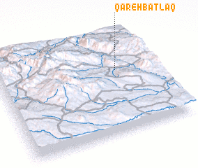 Places with similar names to Qareh Bāţlāq, Iran :: Disclaimer :: Information on this page comes without warranty of any kind |
||
|
Where is Qareh Bāţlāq? Elevation and coordinates ::
Latitude (lat): 36°38'0"N Longitude (lon): 47°46'0"E
Elevation (approx.): 1297m (map arrows pan, magnifying glasses zoom) |
||
|
Visiting Qareh Bāţlāq? Hotel/Accommodation ::
Book a hotel in Qareh Bāţlāq Travel Guide ::
Buy a travel guide for Iran rental cars ::
car rental offers GPS waypoint ::
download a GPX waypoint (PoI) of Qareh Bāţlāq for your GPS receiver
|
||