|
search place name
|
||
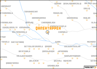
Qareh Tappeh (Kermān, Iran)Qareh Tappeh is a town in the Kermān region of Iran. An overview map of the region around Qareh Tappeh is displayed below.
regional and 3d topo map of Qareh Tappeh, Iran ::
Qareh Tappeh airports ::
The nearest airport is TBZ - Tabriz Intl, located 128.3 km north west of Qareh Tappeh.
Nearby towns ::
Chanāq Bolāgh (3.7km north) //
Sowme‘eh-ye Soflá (3.8km north east) //
Khvājeh Ghīās̄ (4.7km north west) //
‘Ajamī (4.7km south east) //
Chapqolū (4.4km east) //
Qomqān (5.6km south) //
Pūrsekhlū (5.8km south) //
Ḩammām Darreh (6.3km north west) //
Gavanlū (6.3km south west) //
Qarehjeh Qīā (7.4km south) //
Ātdarrahsī (6.2km west) //
Bayāt-e Soflá (7.1km south west) //
Nowdelaq (8.0km north) //
Ūranjaq (6.9km north west) //
Āghcheh Darband (8.0km south) //
Seyyedlar (8.1km south west) //
Ja‘farābād (8.6km south east) //
Torkamān Chāy (9.6km north west) //
[all distances 'as the bird flies' and approximate]  Places with similar names to Qareh Tappeh, Iran ::
Disclaimer :: Information on this page comes without warranty of any kind |
||
|
Where is Qareh Tappeh? Elevation and coordinates ::
Latitude (lat): 37°31'0"N Longitude (lon): 47°28'0"E
Elevation (approx.): 1519m (map arrows pan, magnifying glasses zoom) |
||
|
Visiting Qareh Tappeh? Hotel/Accommodation ::
Book a hotel in Qareh Tappeh Travel Guide ::
Buy a travel guide for Iran rental cars ::
car rental offers GPS waypoint ::
download a GPX waypoint (PoI) of Qareh Tappeh for your GPS receiver
|
||