|
search place name
|
||
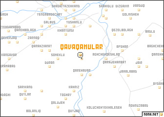
Qavāq ‘Amūlar (Ostān-e Āz̄arbāyjān-e Sharqī, Iran)Qavāq ‘Amūlar is a town in the Ostān-e Āz̄arbāyjān-e Sharqī region of Iran. An overview map of the region around Qavāq ‘Amūlar is displayed below.
regional and 3d topo map of Qavāq ‘Amūlar, Iran ::
Qavāq ‘Amūlar airports ::
The nearest airport is RAS - Rasht, located 163.1 km east of Qavāq ‘Amūlar.
Other airports nearby include TBZ - Tabriz Intl (163.7 km north west), Nearby towns ::
Bālesh Kandī (0.0km north) //
Qareh Āvar (3.7km south) //
Gerdeh Lāyan (4.0km south) //
Āghcheh Qeshlāq (4.4km east) //
Someklū (4.4km west) //
Khānyūrdī (6.3km north west) //
Qarājeh Arbāţ (6.2km east) //
Qāflānkūh (7.6km north) //
Dūrān (6.2km west) //
Deym Daghī (6.2km west) //
Kahrīz (7.6km south) //
Yūshānlū (7.6km north) //
Yengābād-e Kūh (8.0km north) //
Gachī Līk (8.1km north east) //
Galbūs (9.5km north west) //
[all distances 'as the bird flies' and approximate] 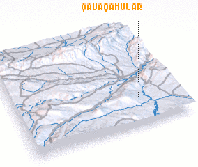 Places with similar names to Qavāq ‘Amūlar, Iran :: Disclaimer :: Information on this page comes without warranty of any kind |
||
|
Where is Qavāq ‘Amūlar? Elevation and coordinates ::
Latitude (lat): 37°18'0"N Longitude (lon): 47°46'0"E
Elevation (approx.): 1343m (map arrows pan, magnifying glasses zoom) |
||
|
Visiting Qavāq ‘Amūlar? Hotel/Accommodation ::
Book a hotel in Qavāq ‘Amūlar Travel Guide ::
Buy a travel guide for Iran rental cars ::
car rental offers GPS waypoint ::
download a GPX waypoint (PoI) of Qavāq ‘Amūlar for your GPS receiver
|
||