|
search place name
|
||
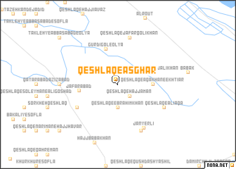
Qeshlāq-e Aşghar (Ostān-e Āz̄arbāyjān-e Gharbī, Iran)Qeshlāq-e Aşghar is a town in the Ostān-e Āz̄arbāyjān-e Gharbī region of Iran. An overview map of the region around Qeshlāq-e Aşghar is displayed below.
regional and 3d topo map of Qeshlāq-e Aşghar, Iran ::
Qeshlāq-e Aşghar airports ::
The nearest airport is BAK - Baku Heydar Aliyev, located 196.5 km north east of Qeshlāq-e Aşghar.
Other airports nearby include TBZ - Tabriz Intl (222.6 km south west), Nearby towns ::
Qeshlāq-e Ḩājj Savād (1.9km north) //
Qeshlāq-e Mollālū (2.3km north west) //
Qeshlāq-e Āqā Khān-e Karāmat (2.3km north east) //
Qeshlāq-e Ḩājj Aman (2.3km south east) //
Qeshlāq-e Ebrāhīm Khān (3.7km south) //
Qeshlāq-e Āqā Khān-e Ekhtīār (4.3km east) //
Qeshlāq-e Ḩājj ‘Alī Khān (4.7km north east) //
Gūrdīgol-e ‘Olyā (5.7km north) //
Ja‘farābād (4.9km west) //
Chālmeh Kandī (6.2km south west) //
Qeshlāq-e Ja‘far Qolī Khān (7.5km north) //
Jānyerlī (7.7km south east) //
Rūḩ Kandī (7.9km south) //
Khān Bābā Kandī (7.9km south) //
Qeshlāq-e ‘Alī Āqā (6.8km south east) //
[all distances 'as the bird flies' and approximate] 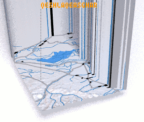 Places with similar names to Qeshlāq-e Aşghar, Iran :: Disclaimer :: Information on this page comes without warranty of any kind |
||
|
Where is Qeshlāq-e Aşghar? Elevation and coordinates ::
Latitude (lat): 39°28'0"N Longitude (lon): 48°9'0"E
Elevation (approx.): 158m (map arrows pan, magnifying glasses zoom) |
||
|
Visiting Qeshlāq-e Aşghar? Hotel/Accommodation ::
Book a hotel in Qeshlāq-e Aşghar Travel Guide ::
Buy a travel guide for Iran rental cars ::
car rental offers GPS waypoint ::
download a GPX waypoint (PoI) of Qeshlāq-e Aşghar for your GPS receiver
|
||