|
search place name
|
||
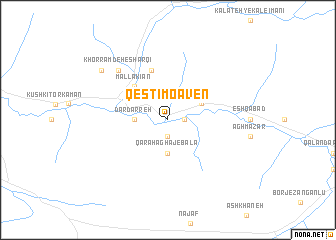
Qesţī Mo‘āven (Khorāsān, Iran)Qesţī Mo‘āven is a town in the Khorāsān region of Iran. An overview map of the region around Qesţī Mo‘āven is displayed below.
regional and 3d topo map of Qesţī Mo‘āven, Iran ::
Qesţī Mo‘āven airports ::
The nearest airport is ASB - Ashkhabad Ashgabat, located 138.2 km east of Qesţī Mo‘āven.
Nearby towns ::
Qarah Āghāj-e Sarband (1.9km south) //
Qal‘eh Bīd (1.5km east) //
Dār Darreh (2.9km west) //
Qarah Āghāj-e Bālā (3.7km south) //
Qarah Āghāj-e Pā'īn (2.9km west) //
Shesh Khāneh (3.5km north east) //
Mallākīān (4.7km north west) //
Cheshmeh-ye Gāgūl (5.7km north) //
Khorramdeh-e Sharqī (7.1km north west) //
Khorramdeh-e Gharbī (8.1km north west) //
[all distances 'as the bird flies' and approximate]  Places with similar names to Qesţī Mo‘āven, Iran :: Disclaimer :: Information on this page comes without warranty of any kind |
||
|
Where is Qesţī Mo‘āven? Elevation and coordinates ::
Latitude (lat): 37°42'0"N Longitude (lon): 56°50'0"E
Elevation (approx.): 544m (map arrows pan, magnifying glasses zoom) |
||
|
Visiting Qesţī Mo‘āven? Hotel/Accommodation ::
Book a hotel in Qesţī Mo‘āven Travel Guide ::
Buy a travel guide for Iran rental cars ::
car rental offers GPS waypoint ::
download a GPX waypoint (PoI) of Qesţī Mo‘āven for your GPS receiver
|
||