|
search place name
|
||
Qeyţāsābād (Ostān-e Kermānshāh, Iran)Qeyţāsābād is a town in the Ostān-e Kermānshāh region of Iran. An overview map of the region around Qeyţāsābād is displayed below.
regional and 3d topo map of Qeyţāsābād, Iran ::

Qeyţāsābād airports ::
The nearest airport is KSH - Bakhtaran Shahid Ashrafi Esfahani, located 38.7 km south west of Qeyţāsābād.
Other airports nearby include SDG - Sanandaj (84.6 km north west), Nearby towns ::
‘Azīzābād (1.7km south) //
Shakīb (1.5km east) //
Kolahjūb (1.5km west) //
Mīān Rāhān (2.1km south west) //
Chameh (2.2km south east) //
Bābā Kamāl-e ‘Olyā (2.4km north east) //
Bābā Kamāl-e Soflá (2.4km north east) //
Tappeh-ye Kolūcheh (2.4km north west) //
Kheyrābād (2.8km west) //
Amīnābād (3.5km north west) //
Karkasār (3.8km north) //
Cherāghābād (3.6km north east) //
Shāh Mār (4.0km north) //
Zībā Jūb (4.0km north) //
Cheshmeh Kabūd (4.8km south west) //
Naz̧arābād (4.8km north east) //
Emāmzādeh (4.8km north west) //
Amīrābād (4.8km north west) //
Harīleh (5.6km north) //
Pīr Qāsem (4.6km west) //
Maryam Negār (4.6km east) //
Aḩmadābād (4.6km east) //
Bālājūb (5.8km north) //
Shahyār (5.8km north) //
Deh Khānjān (4.9km west) //
Qal‘eh-ye Deh Khānjān (4.9km west) //
Seyyed Shahāb (4.9km west) //
Ţāherābād (4.9km west) //
Karaj-e Soflá (4.9km east) //
[all distances 'as the bird flies' and approximate] 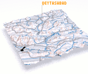 Places with similar names to Qeyţāsābād, Iran :: Disclaimer :: Information on this page comes without warranty of any kind |
||
|
Where is Qeyţāsābād? Elevation and coordinates ::
Latitude (lat): 34°35'0"N Longitude (lon): 47°28'0"E
Elevation (approx.): 1351m (map arrows pan, magnifying glasses zoom) |
||
|
Visiting Qeyţāsābād? Hotel/Accommodation ::
Book a hotel in Qeyţāsābād Travel Guide ::
Buy a travel guide for Iran rental cars ::
car rental offers GPS waypoint ::
download a GPX waypoint (PoI) of Qeyţāsābād for your GPS receiver
|
||