|
search place name
|
||
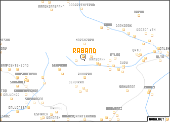
Rāband (Iran)Rāband is a town in Iran. An overview map of the region around Rāband is displayed below.
regional and 3d topo map of Rāband, Iran ::
Rāband airports ::
The nearest airport is KER - Kerman, located 105.6 km north of Rāband.
Nearby towns ::
Eylāq (1.6km north east) //
Dasht-e Shaghīn (1.6km west) //
Kam Sorkh (2.5km east) //
Dasht-e Shaghīn (2.9km east) //
Morghzārū (3.7km north) //
Ākhūrak (3.7km south) //
Bīd Shīrīn (4.6km east) //
Şarfeh (4.8km east) //
Bandar-e Hanzā (5.2km south west) //
Deh Vīrān (5.8km south) //
Gorūh (5.2km east) //
Bāb Mādū'īyeh (5.2km east) //
Deh Vīrān (5.2km west) //
Bāb Kahnūj (6.0km south) //
Dar-e Āsyāb (5.7km east) //
Masjed (6.5km south) //
Eylāq (5.9km east) //
Olāgh Kosh (6.8km south) //
Aḩmadābād (6.7km east) //
Bāb Ţāhūneh (6.7km east) //
Gorveh (6.8km east) //
Bāgh-e Sū (8.0km north east) //
Kadbak (7.5km east) //
Gūrū (7.6km east) //
Bāb Khīdūʼīyeh (7.7km east) //
Gāhū (8.4km north east) //
Hanzā (9.2km south west) //
Darkorak (10.2km north east) //
[all distances 'as the bird flies' and approximate]  Places with similar names to Rāband, Iran ::
// Rebentão (BR)
// Rio Bonito (BR)
// Rio Bonito (BR)
// Rio Bonito (BR)
// Rio Bonito (BR)
// Rio Bonito (BR)
// Rio Bonito (BR)
// Rio Bonito (BR)
// Rio Bonito (BR)
// Rio Bonito (BR)
Disclaimer :: Information on this page comes without warranty of any kind |
||
|
Where is Rāband? Elevation and coordinates ::
Latitude (lat): 29°22'0"N Longitude (lon): 57°17'0"E
Elevation (approx.): 3138m (map arrows pan, magnifying glasses zoom) |
||
|
Visiting Rāband? Hotel/Accommodation ::
Book a hotel in Rāband Travel Guide ::
Buy a travel guide for Iran rental cars ::
car rental offers GPS waypoint ::
download a GPX waypoint (PoI) of Rāband for your GPS receiver
|
||