|
search place name
|
||
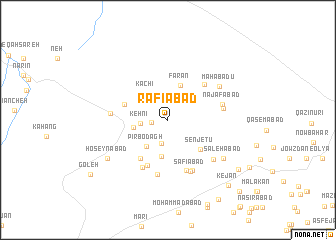
Rafī‘ābād (Eşfahān, Iran)Rafī‘ābād is a town in the Eşfahān region of Iran. An overview map of the region around Rafī‘ābād is displayed below.
regional and 3d topo map of Rafī‘ābād, Iran ::
Rafī‘ābād airports ::
The nearest airport is AZD - Yazd Shahid Sadooghi, located 195.1 km south east of Rafī‘ābād.
Nearby towns ::
Sanābād (1.6km west) //
Dīzejī (2.7km south) //
Kehnī (2.7km west) //
Kachī (3.5km north west) //
Pīr Bodāgh (3.6km south west) //
Nohūj (3.3km west) //
Farān (4.0km north) //
Ferān (4.0km north) //
Kheyrābād (4.1km south) //
Senjetū (4.5km south east) //
‘Ashīneh (4.5km west) //
Shamsābād (5.0km south west) //
Cholāqābād (5.5km south) //
Tūrān (5.2km north east) //
Moḩammadābād (5.9km south) //
Veshteh (5.9km south west) //
Kūlīān (6.1km south) //
Ḩabībābād (6.1km south) //
Şafīābād (6.1km south) //
Moz̧affarābād (5.3km east) //
Muzāfābād (5.3km east) //
Najafābād (5.4km east) //
Mārchūbeh (5.4km west) //
Āshnān (6.1km south east) //
Mahābādū (6.1km north east) //
Şāleḩābād (6.7km south east) //
Ḩoseynābād (7.1km south west) //
Ḩeydarābād (7.1km south west) //
Vandīsh (8.6km south east) //
[all distances 'as the bird flies' and approximate] 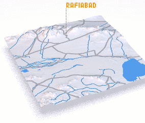 Places with similar names to Rafī‘ābād, Iran ::
Disclaimer :: Information on this page comes without warranty of any kind |
||
|
Where is Rafī‘ābād? Elevation and coordinates ::
Latitude (lat): 32°57'18"N Longitude (lon): 52°36'41"E
Elevation (approx.): 2135m (map arrows pan, magnifying glasses zoom) |
||
|
Visiting Rafī‘ābād? Hotel/Accommodation ::
Book a hotel in Rafī‘ābād Travel Guide ::
Buy a travel guide for Iran rental cars ::
car rental offers GPS waypoint ::
download a GPX waypoint (PoI) of Rafī‘ābād for your GPS receiver
|
||