|
search place name
|
||
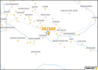
Razdar (Lorestān, Iran)Razdar is a town in the Lorestān region of Iran. An overview map of the region around Razdar is displayed below.
regional and 3d topo map of Razdar, Iran ::
Razdar airports ::
The nearest airport is QMJ - Masjed Soleiman Shahid Asyaee, located 159.7 km south of Razdar.
Nearby towns ::
Emāmābād (1.6km north west) //
Chamnār (2.3km south west) //
Pāzardālū (2.5km east) //
Mīānrūdān (3.3km east) //
Ḩeshmatābād (4.0km north west) //
Torshāb (4.3km north west) //
Kalkaleh (4.0km east) //
Khānābād (4.3km north east) //
Gandāb (4.7km north east) //
Qal‘eh-ye Rostam (4.9km south east) //
Gāv Koshteh (5.0km north west) //
Torshāb (5.5km north west) //
Sīreh-ye Pāʼīn (5.2km south west) //
Khargūsh Khānī (6.5km north) //
Sīreh-ye Bālā (5.8km south west) //
Soranjeh (7.0km north) //
Bīdestāneh (6.7km south east) //
Shāhzādeh ‘Abdollāh (6.6km south west) //
Choghādūn (7.1km north west) //
Maḩmūdābād (6.5km east) //
Sabzān (7.6km north west) //
Ţīān (7.4km east) //
Darb-e Āstāneh (7.5km south west) //
Sarāvand (8.4km south west) //
Sīzār (8.3km north west) //
Būdīneh (9.4km north west) //
Kūh-e Chāl Qeyşar (10.5km north east) //
[all distances 'as the bird flies' and approximate] 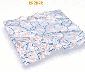 Places with similar names to Razdar, Iran ::
Disclaimer :: Information on this page comes without warranty of any kind |
||
|
Where is Razdar? Elevation and coordinates ::
Latitude (lat): 33°26'29"N Longitude (lon): 49°12'52"E
Elevation (approx.): 1665m (map arrows pan, magnifying glasses zoom) |
||
|
Visiting Razdar? Hotel/Accommodation ::
Book a hotel in Razdar Travel Guide ::
Buy a travel guide for Iran rental cars ::
car rental offers GPS waypoint ::
download a GPX waypoint (PoI) of Razdar for your GPS receiver
|
||