|
search place name
|
||
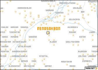
Renāsak Bon (Gīlān, Iran)Renāsak Bon is a town in the Gīlān region of Iran. An overview map of the region around Renāsak Bon is displayed below.
regional and 3d topo map of Renāsak Bon, Iran ::
Renāsak Bon airports ::
The nearest airport is RAS - Rasht, located 39.9 km north of Renāsak Bon.
Other airports nearby include RZR - Ramsar (93.4 km east), THR - Teheran Mehrabad Intl (207.0 km south east), Nearby towns ::
Sargerdū Poshteh (0.0km north) //
Bījār Poshteh (0.0km north) //
Mīān Farārūd (1.9km south) //
Sarfrārūd (1.9km south) //
Anjīlbon (2.4km north east) //
Gerdū Poshteh (2.4km south east) //
Alūbon (4.0km south) //
Berāgūr-e Bālā (4.4km north) //
Kandelāt (4.7km north west) //
Sīāh Kīsh (4.9km north) //
Berāgūr-e Pā'īn (5.6km north) //
Shahr-e Bījār Rūdsarā (5.6km north) //
Shahr Bījār-e Bālā Maḩalleh (5.6km north) //
Keshāf (5.6km north east) //
Shahrān (5.1km west) //
Gol Sarak-e Bālā Maḩalleh (6.4km north) //
Mūsh Bījār (6.1km north east) //
Delamdeh (6.0km north east) //
Gol Sarak-e Sarāvān (6.9km north) //
Sarāvān (7.1km north) //
Chatamrūd (7.0km north) //
Emāmzādeh Hāshem (6.7km north west) //
Ḩalīmeh Jān (6.2km west) //
Bījārkūn (6.2km west) //
Āghūzbon (7.5km north) //
Bārīk Rūd (6.6km north west) //
Bārīk Rūd (6.6km north west) //
Salāb (7.1km north east) //
Darreh Maḩalleh (7.6km north west) //
[all distances 'as the bird flies' and approximate] 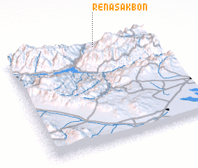 Places with similar names to Renāsak Bon, Iran :: Disclaimer :: Information on this page comes without warranty of any kind |
||
|
Where is Renāsak Bon? Elevation and coordinates ::
Latitude (lat): 36°58'0"N Longitude (lon): 49°38'0"E
Elevation (approx.): 284m (map arrows pan, magnifying glasses zoom) |
||
|
Visiting Renāsak Bon? Hotel/Accommodation ::
Book a hotel in Renāsak Bon Travel Guide ::
Buy a travel guide for Iran rental cars ::
car rental offers GPS waypoint ::
download a GPX waypoint (PoI) of Renāsak Bon for your GPS receiver
|
||