|
search place name
|
||
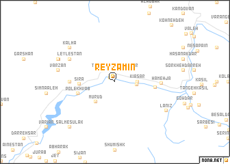
Rey Zamīn (Tehrān, Iran)Rey Zamīn is a town in the Tehrān region of Iran. An overview map of the region around Rey Zamīn is displayed below.
regional and 3d topo map of Rey Zamīn, Iran ::
Rey Zamīn airports ::
The nearest airport is THR - Teheran Mehrabad Intl, located 39.5 km south of Rey Zamīn.
Other airports nearby include RZR - Ramsar (107.9 km north west), RAS - Rasht (202.1 km north west), Nearby towns ::
Āsārā (1.0km north west) //
Tekyeh-e Sepahsālār (1.9km north) //
Takye-ye Sepahsālār (1.9km north) //
Kīāsarlāt (2.9km east) //
Kīāsar (3.0km east) //
Mūrūd (4.1km south west) //
Sīrā (4.7km west) //
Pol-e Khvāb (5.3km west) //
Dardeh (5.4km east) //
Nasht-e Rūd (6.0km west) //
Hamehjā (6.2km east) //
Leylestān (7.0km north west) //
Āyegān (7.0km north west) //
Kalhā (8.2km north west) //
Lānīz (8.3km south east) //
Salm-e Sūlak (9.5km south west) //
Hendūstānak (9.5km south west) //
[all distances 'as the bird flies' and approximate] 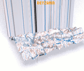 Places with similar names to Rey Zamīn, Iran ::
Disclaimer :: Information on this page comes without warranty of any kind |
||
|
Where is Rey Zamīn? Elevation and coordinates ::
Latitude (lat): 36°2'0"N Longitude (lon): 51°12'0"E
Elevation (approx.): 1881m (map arrows pan, magnifying glasses zoom) |
||
|
Visiting Rey Zamīn? Hotel/Accommodation ::
Book a hotel in Rey Zamīn Travel Guide ::
Buy a travel guide for Iran rental cars ::
car rental offers GPS waypoint ::
download a GPX waypoint (PoI) of Rey Zamīn for your GPS receiver
|
||