|
search place name
|
||
Rīg Anbār (Kermān, Iran)Rīg Anbār is a town in the Kermān region of Iran. An overview map of the region around Rīg Anbār is displayed below.
regional and 3d topo map of Rīg Anbār, Iran ::

Rīg Anbār airports ::
The nearest airport is BND - Bandar Abbass Intl, located 188.2 km south west of Rīg Anbār.
Other airports nearby include KER - Kerman (221.8 km north), Nearby towns ::
Ḩājjīābād (1.6km west) //
Gesāleh-ye Bālā (2.0km west) //
Cheshmeh Shāh (2.2km south west) //
Ḩasanābād (2.5km south west) //
Cheshmeh Shāh (2.5km south west) //
Akbarābād (2.5km north west) //
Gazābād (2.7km west) //
Āb Garm (3.2km north west) //
Gesāleh-ye Pā'īn (3.7km south) //
Allāhābād-e Bālā (3.7km north) //
Gorgābād-e Pā'īn (3.7km north) //
Varāmīn (3.7km north west) //
Amīrābād-e Bālā (4.4km north) //
Seyyedābād (4.2km east) //
Amīrābād-e Pāʼīn (4.4km north east) //
‘Azīzābād (4.6km south east) //
Sharafābād (5.3km north) //
Ebrāhīmābād (5.6km north) //
Ḩoseynābād-e Harandī (5.4km south west) //
Ḩasanābād-e Naz̧arīān (5.8km south west) //
Showkatābād (5.6km south east) //
Qāderābād (6.5km north) //
Fatḩābād (6.5km north) //
Qanāt-e Now (6.4km south west) //
Kūgū'īyeh (6.7km south west) //
Garkū (7.0km south west) //
Moḩammadābād-e Ţūlehgarī (7.2km south) //
Konār Şandal (7.3km north east) //
Deh Now-e Moḩammad Reẕā Khān (7.3km south west) //
[all distances 'as the bird flies' and approximate] 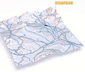 Places with similar names to Rīg Anbār, Iran :: Disclaimer :: Information on this page comes without warranty of any kind |
||
|
Where is Rīg Anbār? Elevation and coordinates ::
Latitude (lat): 28°24'0"N Longitude (lon): 57°45'0"E
Elevation (approx.): 548m (map arrows pan, magnifying glasses zoom) |
||
|
Visiting Rīg Anbār? Hotel/Accommodation ::
Book a hotel in Rīg Anbār Travel Guide ::
Buy a travel guide for Iran rental cars ::
car rental offers GPS waypoint ::
download a GPX waypoint (PoI) of Rīg Anbār for your GPS receiver
|
||