|
search place name
|
||
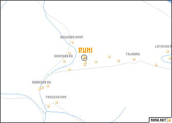
Rūmī (Fārs, Iran)Rūmī is a town in the Fārs region of Iran. An overview map of the region around Rūmī is displayed below.
regional and 3d topo map of Rūmī, Iran ::
Rūmī airports ::
The nearest airport is SYZ - Shiraz Shahid Dastghaib Intl, located 114.9 km west of Rūmī.
Nearby towns ::
‘Abbāsābād (0.2km south west) //
Dehūyeh (0.8km south) //
Moḩammadābād Dohūyeh (1.9km east) //
‘Alīābād-e Shams (3.6km south west) //
Rownīz-e Pā'īn (3.7km north west) //
Shamsābād (4.1km west) //
Bodūr Bahman (4.9km north west) //
Ḩoseynābād-e Jangal (4.6km east) //
Rownīz-e Bālā (6.2km east) //
Sorkhak (9.0km south west) //
Tang-e Karam (10.5km south west) //
[all distances 'as the bird flies' and approximate] 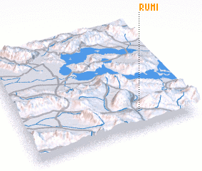 Places with similar names to Rūmī, Iran ::
Disclaimer :: Information on this page comes without warranty of any kind |
||
|
Where is Rūmī? Elevation and coordinates ::
Latitude (lat): 29°11'25"N Longitude (lon): 53°42'16"E
Elevation (approx.): 1564m (map arrows pan, magnifying glasses zoom) |
||
|
Visiting Rūmī? Hotel/Accommodation ::
Book a hotel in Rūmī Travel Guide ::
Buy a travel guide for Iran rental cars ::
car rental offers GPS waypoint ::
download a GPX waypoint (PoI) of Rūmī for your GPS receiver
|
||