|
search place name
|
||
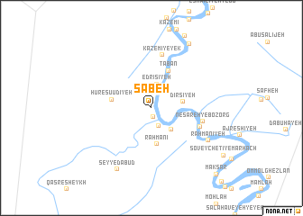
Sab‘eh (Khūzestān, Iran)Sab‘eh is a town in the Khūzestān region of Iran. An overview map of the region around Sab‘eh is displayed below.
regional and 3d topo map of Sab‘eh, Iran ::
Sab‘eh airports ::
The nearest airport is AWZ - Ahwaz, located 60.7 km north east of Sab‘eh.
Other airports nearby include ABD - Abadan (62.3 km south), BSR - Basrah Intl (77.4 km south west), MRX - Bandar Mahshahr Mahshahr (87.4 km south east), QMJ - Masjed Soleiman Shahid Asyaee (148.5 km north east), Nearby towns ::
Sharī‘eh (1.1km south) //
Raḩmanī-ye Ka‘bī (2.3km south) //
Deym Ebn-e Najm (2.7km north) //
Edrīsīyeh (3.0km north) //
Raḩmānīyeh (3.4km south east) //
Dīrsīyeh (3.4km east) //
Raḩmānī (4.5km south) //
Hūr-e Şū‘ūdīyeh (4.4km west) //
Tābān (5.0km north) //
Nes̄āreh-ye Kūchek (5.7km south east) //
Nes̄āreh-ye Bozorg (5.7km east) //
Kāz̧emī-ye Yek (6.7km north) //
Raḩmānīyeh (7.3km south east) //
Seyyed ‘Abūd (8.4km south west) //
Chamīān (8.9km north east) //
Soveychetī-ye Marhach (9.6km south east) //
Maksar (10.7km south east) //
[all distances 'as the bird flies' and approximate] 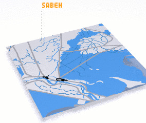 Places with similar names to Sab‘eh, Iran ::
Disclaimer :: Information on this page comes without warranty of any kind |
||
|
Where is Sab‘eh? Elevation and coordinates ::
Latitude (lat): 30°55'26"N Longitude (lon): 48°20'40"E
Elevation (approx.): 9m (map arrows pan, magnifying glasses zoom) |
||
|
Visiting Sab‘eh? Hotel/Accommodation ::
Book a hotel in Sab‘eh Travel Guide ::
Buy a travel guide for Iran rental cars ::
car rental offers GPS waypoint ::
download a GPX waypoint (PoI) of Sab‘eh for your GPS receiver
|
||