|
search place name
|
||
Şafdarābād (Eşfahān, Iran)Şafdarābād is a town in the Eşfahān region of Iran. An overview map of the region around Şafdarābād is displayed below.
regional and 3d topo map of Şafdarābād, Iran ::

Şafdarābād airports ::
The nearest airport is SYZ - Shiraz Shahid Dastghaib Intl, located 176.6 km south east of Şafdarābād.
Other airports nearby include BUZ - Bushehr (229.7 km south), Nearby towns ::
Tal Moḩammad (0.6km south) //
Deh Bozorg (1.7km south east) //
Dowrāhān (2.1km north east) //
Dorāhān (2.2km north east) //
Daverjān-e Bālā (2.5km north east) //
Bāgh Shahbāz (2.4km south east) //
Kahangān (2.4km east) //
Devergān-e Pā'īn (3.1km north) //
Dengezlū (3.1km south east) //
Noqol (3.6km south east) //
Kal Balī (3.9km north) //
Kīfteh (3.7km north east) //
Deng-e Zolī (4.0km south east) //
Daverjān-e Soflá (4.4km north east) //
Bārand-e Pā'īn (5.4km north) //
Bānī (6.2km north) //
Tang-e Chūneh (5.6km west) //
Bīdeh (5.9km north east) //
Bārand-e Bālā (6.8km north) //
Lūysakh (7.4km south) //
Sheybānī (7.6km north) //
Sarbāz (8.1km north) //
Ganjegān (7.5km east) //
Bāzārgāh (7.6km east) //
[all distances 'as the bird flies' and approximate] 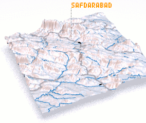 Places with similar names to Şafdarābād, Iran ::
// Şafdarābād (IR)
Disclaimer :: Information on this page comes without warranty of any kind |
||
|
Where is Şafdarābād? Elevation and coordinates ::
Latitude (lat): 30°53'51"N Longitude (lon): 51°37'50"E
Elevation (approx.): 2228m (map arrows pan, magnifying glasses zoom) |
||
|
Visiting Şafdarābād? Hotel/Accommodation ::
Book a hotel in Şafdarābād Travel Guide ::
Buy a travel guide for Iran rental cars ::
car rental offers GPS waypoint ::
download a GPX waypoint (PoI) of Şafdarābād for your GPS receiver
|
||