|
search place name
|
||
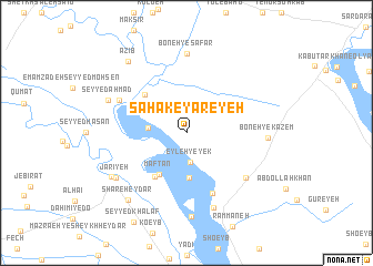
Saḩāk-e Yareyeḩ (Khūzestān, Iran)Saḩāk-e Yareyeḩ is a town in the Khūzestān region of Iran. An overview map of the region around Saḩāk-e Yareyeḩ is displayed below.
regional and 3d topo map of Saḩāk-e Yareyeḩ, Iran ::
Saḩāk-e Yareyeḩ airports ::
The nearest airport is QMJ - Masjed Soleiman Shahid Asyaee, located 61.1 km east of Saḩāk-e Yareyeḩ.
Other airports nearby include AWZ - Ahwaz (66.2 km south), MRX - Bandar Mahshahr Mahshahr (159.6 km south), ABD - Abadan (176.4 km south), BSR - Basrah Intl (178.2 km south west), Nearby towns ::
‘Eyleh-ye Yek (3.0km south) //
Dohūl (3.3km west) //
Khammās (4.5km south) //
Maftan (4.8km south west) //
Khalīfeh-ye Ḩeydar (5.1km south west) //
Khoẕeyyer (5.3km north west) //
Yeshān Sakhī (5.4km north west) //
Boneh-ye Zeydān (6.4km south) //
Mo'asseseh-ye Amīrḩoseyn Khān (6.8km south east) //
Goţeysh (6.7km north west) //
Boneh-ye Şafar (7.9km north) //
‘Abd ol Sādāt (7.9km south) //
Boneh-ye Kāz̧em (6.9km east) //
Kāz̧em-e Ḩeydar (8.4km south) //
Jarīyeh (7.6km south west) //
Seyyed Aḩmad (7.5km north west) //
Ḩomeylā (7.8km south west) //
Shāre‘ Ḩeydar (8.4km south west) //
‘Azīb (8.7km north west) //
[all distances 'as the bird flies' and approximate] 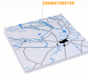 Places with similar names to Saḩāk-e Yareyeḩ, Iran :: Disclaimer :: Information on this page comes without warranty of any kind |
||
|
Where is Saḩāk-e Yareyeḩ? Elevation and coordinates ::
Latitude (lat): 31°55'26"N Longitude (lon): 48°37'51"E
Elevation (approx.): 36m (map arrows pan, magnifying glasses zoom) |
||
|
Visiting Saḩāk-e Yareyeḩ? Hotel/Accommodation ::
Book a hotel in Saḩāk-e Yareyeḩ Travel Guide ::
Buy a travel guide for Iran rental cars ::
car rental offers GPS waypoint ::
download a GPX waypoint (PoI) of Saḩāk-e Yareyeḩ for your GPS receiver
|
||