|
search place name
|
||
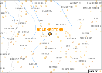
Şalāḩ Payahsī (Iran)Şalāḩ Payahsī is a town in Iran. An overview map of the region around Şalāḩ Payahsī is displayed below.
regional and 3d topo map of Şalāḩ Payahsī, Iran ::
Şalāḩ Payahsī airports ::
The nearest airport is TBZ - Tabriz Intl, located 136.3 km south west of Şalāḩ Payahsī.
Nearby towns ::
Khūybārlū (1.9km south) //
Mazra‘eh-ye Akrā (1.4km west) //
Ābesh Aḩmad (1.8km north east) //
Mota‘alleq (1.9km west) //
Rostam Kandī (2.3km north west) //
Amīrābād (2.0km east) //
‘Alīshārī (2.5km west) //
Dāshlī (2.9km west) //
Homū (3.3km south east) //
Sheykhlān-e ‘Olyā (3.5km north west) //
Tāzeh Kand-e Dāvūdlū (3.4km south east) //
Qūshchī (4.0km south) //
Khūbyārlū (4.0km south) //
Ḩaddādan (3.9km south west) //
Qūsheh Bolāgh (4.6km north) //
Qal'eh Kandī (4.1km south west) //
Kalāntar (4.5km north east) //
Sheykhlān-e Soflá (4.7km north west) //
‘Allūlū (4.3km east) //
Ājūdānābād (4.3km east) //
Khān Kandī (5.6km south) //
Pīrāsmellū (5.0km south east) //
Sardārābād (4.7km north east) //
Zarbīl (5.5km north west) //
Qūytūl (5.1km east) //
Molk-e Daraq (6.3km south east) //
Vīrāvjen (5.3km east) //
Qūshchī Bāyrām Khvājeh (5.5km east) //
Dībaklū (7.6km south) //
[all distances 'as the bird flies' and approximate] 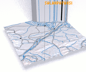 Places with similar names to Şalāḩ Payahsī, Iran :: Disclaimer :: Information on this page comes without warranty of any kind |
||
|
Where is Şalāḩ Payahsī? Elevation and coordinates ::
Latitude (lat): 39°2'0"N Longitude (lon): 47°18'0"E
Elevation (approx.): 962m (map arrows pan, magnifying glasses zoom) |
||
|
Visiting Şalāḩ Payahsī? Hotel/Accommodation ::
Book a hotel in Şalāḩ Payahsī Travel Guide ::
Buy a travel guide for Iran rental cars ::
car rental offers GPS waypoint ::
download a GPX waypoint (PoI) of Şalāḩ Payahsī for your GPS receiver
|
||