|
search place name
|
||
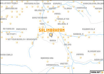
Salīm Bahrām (Iran)Salīm Bahrām is a town in Iran. An overview map of the region around Salīm Bahrām is displayed below.
regional and 3d topo map of Salīm Bahrām, Iran ::
Salīm Bahrām airports ::
The nearest airport is THR - Teheran Mehrabad Intl, located 182.0 km south west of Salīm Bahrām.
Nearby towns ::
Salīm Sheykh (1.2km west) //
Sang Bon (1.8km north) //
Hūlār-e Bālā (1.8km east) //
Hūlār-e Pā'īn (1.8km east) //
Talū Kūlā (2.1km north west) //
Amreh (2.4km south) //
Mashown Kolā (2.7km west) //
Darwār (3.2km north west) //
Chāl Kīādeh (3.2km north west) //
‘Alavī Kolā (3.3km east) //
Darūpey (3.8km north east) //
Pahneh Kolā-ye Jonūbī (4.0km north west) //
Garmestān (3.9km east) //
Garm Rūd (4.0km east) //
Term (4.5km north west) //
Dalāk Kheyl (4.2km west) //
Setūn Kolā (4.2km west) //
Bālā Kolā (4.9km north east) //
Parchī Kolā (5.6km north) //
Shektā (5.0km north west) //
Pahneh Kolā-ye Shomālī (4.7km east) //
Sar Kat (5.1km east) //
Pā'īn Kolā (6.2km north) //
Sāneh Kheyl (6.1km north) //
Āhū Dasht (5.4km east) //
Tang-e Lateh (6.4km north east) //
Golūrd (6.1km south east) //
Sang Tarāshān (6.8km north west) //
Bīsheh Sar (6.0km west) //
[all distances 'as the bird flies' and approximate] 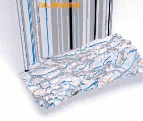 Places with similar names to Salīm Bahrām, Iran :: Disclaimer :: Information on this page comes without warranty of any kind |
||
|
Where is Salīm Bahrām? Elevation and coordinates ::
Latitude (lat): 36°26'3"N Longitude (lon): 53°6'49"E
Elevation (approx.): 328m (map arrows pan, magnifying glasses zoom) |
||
|
Visiting Salīm Bahrām? Hotel/Accommodation ::
Book a hotel in Salīm Bahrām Travel Guide ::
Buy a travel guide for Iran rental cars ::
car rental offers GPS waypoint ::
download a GPX waypoint (PoI) of Salīm Bahrām for your GPS receiver
|
||