|
search place name
|
||
Salmānābād (Iran)Salmānābād is a town in Iran. An overview map of the region around Salmānābād is displayed below.
regional and 3d topo map of Salmānābād, Iran ::

Salmānābād airports ::
The nearest airport is TBZ - Tabriz Intl, located 213.4 km south west of Salmānābād.
Nearby towns ::
Pīrāyūvātlū (0.7km north west) //
Ayāz Kandī (1.2km north west) //
Shāhsūn (1.9km north) //
Chelāvdār (2.3km south west) //
Kasīḩlī (2.5km south west) //
Khalīl Kandī (3.4km north east) //
Ūltān (3.4km south west) //
Paryā Katlī (3.5km north east) //
Qaradağlı (5.1km north) //
Lūleh Daraq-e Ḩājj Najaf (5.6km south) //
Birinci Şahsevǝn (4.6km north west) //
Eslāmābād-e Soflá (5.7km south) //
Yuxarı Çǝmǝnli (6.1km north) //
Qarah Dāghlū (5.3km north east) //
Ebrāhīmābād-e Jadīd (5.3km east) //
‘Alīrezāābād (6.3km south west) //
‘Alīrezāābād-e Qadīm (6.0km south west) //
Aşağı Çǝmǝnli (7.5km north) //
Eslāmābād-e ‘Olyā (7.0km south east) //
Boyūk Khānlū (7.4km north east) //
[all distances 'as the bird flies' and approximate] 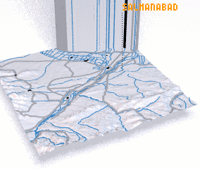 Places with similar names to Salmānābād, Iran ::
// Sleemanābād (IN)
// Salmānābād (IR)
// Salmānābād (IR)
// Salmānābād (IR)
// Salmānābād (IR)
// Salmānābād (IR)
// Salmānābād (IR)
// Salmānābād (IR)
// Soleymānābād (IR)
// Soleymānābād (IR)
Disclaimer :: Information on this page comes without warranty of any kind |
||
|
Where is Salmānābād? Elevation and coordinates ::
Latitude (lat): 39°37'0"N Longitude (lon): 47°48'0"E
Elevation (approx.): 63m (map arrows pan, magnifying glasses zoom) |
||
|
Visiting Salmānābād? Hotel/Accommodation ::
Book a hotel in Salmānābād Travel Guide ::
Buy a travel guide for Iran rental cars ::
car rental offers GPS waypoint ::
download a GPX waypoint (PoI) of Salmānābād for your GPS receiver
|
||