|
search place name
|
||
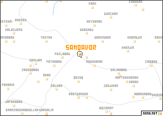
Samqāvor (Iran)Samqāvor is a town in Iran. An overview map of the region around Samqāvor is displayed below.
regional and 3d topo map of Samqāvor, Iran ::
Samqāvor airports ::
The nearest airport is THR - Teheran Mehrabad Intl, located 202.3 km north east of Samqāvor.
Nearby towns ::
Şam‘ Āvar (1.0km east) //
Rowshanā”ī (3.1km south east) //
Faẕlābād (3.6km west) //
Qāz̄ūq (5.5km south) //
‘Ūd Āghāj (5.7km north) //
Darvīshān (5.5km north east) //
Fatḩābād (5.4km west) //
Meydānak (7.9km north) //
Tekyeh (7.6km north west) //
Kalvān (8.6km south west) //
Anār (8.2km south west) //
Salīmābād (8.0km south east) //
Zanjīrān (9.2km south east) //
[all distances 'as the bird flies' and approximate] 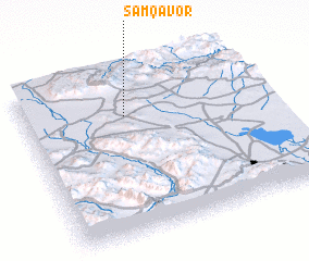 Places with similar names to Samqāvor, Iran ::
Disclaimer :: Information on this page comes without warranty of any kind |
||
|
Where is Samqāvor? Elevation and coordinates ::
Latitude (lat): 34°43'57"N Longitude (lon): 49°25'21"E
Elevation (approx.): 1871m (map arrows pan, magnifying glasses zoom) |
||
|
Visiting Samqāvor? Hotel/Accommodation ::
Book a hotel in Samqāvor Travel Guide ::
Buy a travel guide for Iran rental cars ::
car rental offers GPS waypoint ::
download a GPX waypoint (PoI) of Samqāvor for your GPS receiver
|
||