|
search place name
|
||
Sanār-e Bālā (Iran)Sanār-e Bālā is a town in Iran. An overview map of the region around Sanār-e Bālā is displayed below.
regional and 3d topo map of Sanār-e Bālā, Iran ::

Sanār-e Bālā airports ::
The nearest airport is RZR - Ramsar, located 69.4 km north west of Sanār-e Bālā.
Other airports nearby include THR - Teheran Mehrabad Intl (91.9 km south), RAS - Rasht (174.3 km north west), Nearby towns ::
Sanār-e Pā'īn (1.6km south east) //
Kalenow-ye Pā'īn (1.5km west) //
Valsh (1.9km north) //
Tūrchāl (1.5km east) //
Chalājūr (2.4km north west) //
Ozār (2.4km north east) //
Valasht (2.4km north east) //
Nargesān (2.4km north east) //
Shemrābād (2.4km south west) //
Largān (2.5km north west) //
Kalenow-ye Bālā (3.4km south) //
Bīrī (3.0km east) //
Golkāh (3.7km south) //
Levarchāl (4.0km north) //
Rāveh (4.0km north) //
Shahrī (3.5km south west) //
Gūytar-e ‘Olyā (3.5km south west) //
Gūytar-e Soflá (3.5km south west) //
Sang Sarak (3.5km south west) //
Banafsheh Deh (3.5km south west) //
Tūlak (3.5km north east) //
Yūsefābād (4.0km south) //
Valar Deh (4.0km south) //
Sarkā' (4.0km north west) //
Samā' (4.5km north) //
Khoshkeh Darreh (4.8km south west) //
Sīrgāh (4.8km south west) //
La‘l-e Bījār (4.8km south east) //
Sangjār (4.8km south east) //
[all distances 'as the bird flies' and approximate] 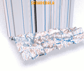 Places with similar names to Sanār-e Bālā, Iran :: Disclaimer :: Information on this page comes without warranty of any kind |
||
|
Where is Sanār-e Bālā? Elevation and coordinates ::
Latitude (lat): 36°31'0"N Longitude (lon): 51°17'0"E
Elevation (approx.): 1081m (map arrows pan, magnifying glasses zoom) |
||
|
Visiting Sanār-e Bālā? Hotel/Accommodation ::
Book a hotel in Sanār-e Bālā Travel Guide ::
Buy a travel guide for Iran rental cars ::
car rental offers GPS waypoint ::
download a GPX waypoint (PoI) of Sanār-e Bālā for your GPS receiver
|
||