|
search place name
|
||
Sang Cheshmeh (Iran)Sang Cheshmeh is a town in Iran. An overview map of the region around Sang Cheshmeh is displayed below.
regional and 3d topo map of Sang Cheshmeh, Iran ::
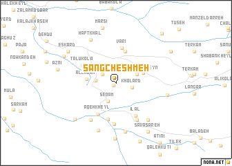
Nearby towns ::
Emāmzādeh ‘Alī (0.5km south west) //
Lālā (2.3km north west) //
Kholard (2.2km east) //
Senām (3.1km south) //
Kīādeh (2.7km west) //
Shāhzādeh Ḩoseyn (3.1km north east) //
Kīāsar (4.0km north east) //
Alendān (3.9km west) //
Shahrak-e Z̄owb-e Āhan (5.3km north) //
Varī (5.7km north) //
‘Aqeh Kheyl (5.6km south west) //
Mīlad Dasht (6.0km south) //
Talū Kolā (5.2km north west) //
Īlāl (5.9km south east) //
Gol Bāgh (6.6km south) //
Sīāvash Kolā (6.6km south east) //
Sa‘īdābād (6.8km south west) //
Kamar Kolā (6.8km south west) //
Āghūz Galleh (7.3km south east) //
Rūdbār (7.9km south) //
Haft Khāl (7.7km north west) //
Kheyrābād (7.9km south) //
Jamāl od Dīn Kolā (7.0km east) //
Z̄akarīyā Kolā (8.0km south west) //
Marsī (9.0km north) //
Eskārd (8.1km north west) //
Savā Sareh (8.9km south east) //
Māzārostāq (8.0km north west) //
Gel Jārī (10.0km north east) //
[all distances 'as the bird flies' and approximate] 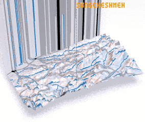 Places with similar names to Sang Cheshmeh, Iran :: Disclaimer :: Information on this page comes without warranty of any kind |
||
|
Where is Sang Cheshmeh? Elevation and coordinates ::
Latitude (lat): 36°13'14"N Longitude (lon): 53°30'11"E
Elevation (approx.): 1308m (map arrows pan, magnifying glasses zoom) |
||
|
Visiting Sang Cheshmeh? Hotel/Accommodation ::
Book a hotel in Sang Cheshmeh Travel Guide ::
Buy a travel guide for Iran rental cars ::
car rental offers GPS waypoint ::
download a GPX waypoint (PoI) of Sang Cheshmeh for your GPS receiver
|
||