|
search place name
|
||
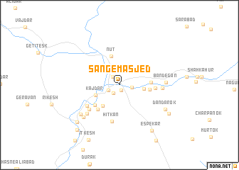
Sang-e Masjed (Sīstān va Balūchestān, Iran)Sang-e Masjed is a town in the Sīstān va Balūchestān region of Iran. An overview map of the region around Sang-e Masjed is displayed below.
regional and 3d topo map of Sang-e Masjed, Iran ::
Sang-e Masjed airports ::
The nearest airport is ZBR - Chah Bahar, located 159.7 km south west of Sang-e Masjed.
Other airports nearby include GWD - Gwadar (188.4 km south east), TRB - Turbo Turbat Intl (189.8 km east), Nearby towns ::
Hūnak (0.9km south) //
Koddān (1.5km south west) //
Kopk (1.6km north west) //
Sarbāz (1.7km south west) //
Mach Mītak (1.8km east) //
Bābaskān (3.3km north west) //
Pandak (3.7km north west) //
Mazākān (3.5km east) //
Ārām Kān (3.7km south west) //
Kajdar (3.7km south west) //
Mogh (4.0km south west) //
Nūt (4.7km north) //
Gelī Dar (4.7km north) //
Bogān (4.3km east) //
Dez (4.5km east) //
Parkān (4.7km south west) //
Ītk (4.9km south west) //
Kareh Gīn (5.0km east) //
Bakhtak (5.9km south) //
Hītkān (5.9km south) //
Gūrdar (5.6km south west) //
Kān (5.7km south west) //
Anzā (6.4km south west) //
Mīnān (6.1km east) //
Bandegān (6.6km east) //
Gorūh (7.1km south west) //
Kūhmītak (7.1km south west) //
Dandārok (7.5km south east) //
Espekār (8.5km south east) //
[all distances 'as the bird flies' and approximate] 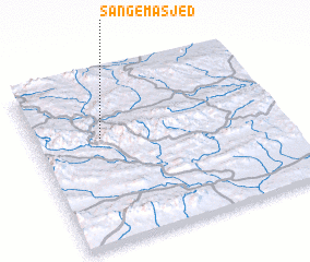 Places with similar names to Sang-e Masjed, Iran :: Disclaimer :: Information on this page comes without warranty of any kind |
||
|
Where is Sang-e Masjed? Elevation and coordinates ::
Latitude (lat): 26°38'23"N Longitude (lon): 61°16'21"E
Elevation (approx.): 928m (map arrows pan, magnifying glasses zoom) |
||
|
Visiting Sang-e Masjed? Hotel/Accommodation ::
Book a hotel in Sang-e Masjed Travel Guide ::
Buy a travel guide for Iran rental cars ::
car rental offers GPS waypoint ::
download a GPX waypoint (PoI) of Sang-e Masjed for your GPS receiver
|
||