|
search place name
|
||
Sanjed Boland-e Pā'īn (Kermān, Iran)Sanjed Boland-e Pā'īn is a town in the Kermān region of Iran. An overview map of the region around Sanjed Boland-e Pā'īn is displayed below.
regional and 3d topo map of Sanjed Boland-e Pā'īn, Iran ::

Sanjed Boland-e Pā'īn airports ::
The nearest airport is KER - Kerman, located 109.9 km north west of Sanjed Boland-e Pā'īn.
Nearby towns ::
Qal‘eh Cheh (0.0km north) //
Sanjed Boland-e Bālā (0.7km south west) //
Ḩoseynābād-e Bālā (1.6km south east) //
Barreh Sūz (1.6km west) //
Khomrūdak (2.1km north west) //
Bāgh-e Razān (2.5km south east) //
Ḩoseynābād-e Qāsem Khān (2.5km south east) //
Ūlyāʼ (2.5km south west) //
Dar Gūrū (2.8km west) //
Dar-e Gūrū (3.7km north west) //
Do Darān (4.4km north west) //
Pol (4.7km south east) //
Dozdū'īyeh (4.9km north west) //
Zīāratgāh (4.9km north west) //
Dar Gūrū Bālā (4.7km west) //
Barasūl (5.2km west) //
Bāb Gorūh (5.2km west) //
Gahūʼīyeh (5.2km west) //
Sa‘īdābād (5.4km south east) //
Geshīgān-e Bālā (5.4km west) //
Darzanīyeh (6.1km north west) //
Gīshīgān-e Pā'īn (5.8km west) //
Do Dāngeh (6.1km south east) //
Rūdkhāneh Pol (6.4km south east) //
Deh-e Shāhverdī-ye Bālā (6.1km east) //
Qatlī (6.1km west) //
Parīvāz (6.6km east) //
Deh-e Shāhverdī-ye Pā'īn (6.7km east) //
Sorkheh'ī (6.7km east) //
[all distances 'as the bird flies' and approximate] 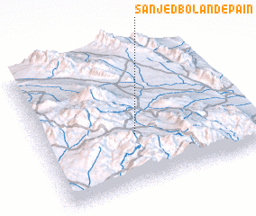 Places with similar names to Sanjed Boland-e Pā'īn, Iran :: Disclaimer :: Information on this page comes without warranty of any kind |
||
|
Where is Sanjed Boland-e Pā'īn? Elevation and coordinates ::
Latitude (lat): 29°23'0"N Longitude (lon): 57°27'0"E
Elevation (approx.): 2386m (map arrows pan, magnifying glasses zoom) |
||
|
Visiting Sanjed Boland-e Pā'īn? Hotel/Accommodation ::
Book a hotel in Sanjed Boland-e Pā'īn Travel Guide ::
Buy a travel guide for Iran rental cars ::
car rental offers GPS waypoint ::
download a GPX waypoint (PoI) of Sanjed Boland-e Pā'īn for your GPS receiver
|
||