|
search place name
|
||
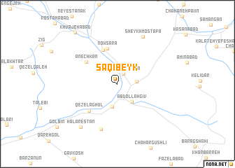
Sāqī Beyk (Khorāsān, Iran)Sāqī Beyk is a town in the Khorāsān region of Iran. An overview map of the region around Sāqī Beyk is displayed below.
regional and 3d topo map of Sāqī Beyk, Iran ::
Sāqī Beyk airports ::
The nearest airport is ASB - Ashkhabad Ashgabat, located 140.7 km north of Sāqī Beyk.
Nearby towns ::
Solţān Meydān (1.8km north east) //
Kalāteh Meydān (2.5km east) //
‘Abdollāh Gīv (3.4km south east) //
Bābā Bohlūl (3.6km south) //
Now Mīrī (5.7km north) //
Now Sarā (5.8km north) //
Anechkān (5.3km north west) //
Qezel Āghūl (5.6km south west) //
Ḩājjīābād (7.5km south) //
Sheykh Moşţafá (8.2km north east) //
Halārestān (8.3km south west) //
Khvājehābād (9.9km north west) //
[all distances 'as the bird flies' and approximate]  Places with similar names to Sāqī Beyk, Iran ::
// Skubiki (PL)
// Skabeikiai (LT)
// Skobač (BA)
// Cioca-Boca (RO)
// Zogbéga (BF)
// Cigabig (ID)
// Sikubak (ID)
// Sagabougou (ML)
// Saguibougou (ML)
// Sakobougou (ML)
Disclaimer :: Information on this page comes without warranty of any kind |
||
|
Where is Sāqī Beyk? Elevation and coordinates ::
Latitude (lat): 36°43'12"N Longitude (lon): 58°24'57"E
Elevation (approx.): 1507m (map arrows pan, magnifying glasses zoom) |
||
|
Visiting Sāqī Beyk? Hotel/Accommodation ::
Book a hotel in Sāqī Beyk Travel Guide ::
Buy a travel guide for Iran rental cars ::
car rental offers GPS waypoint ::
download a GPX waypoint (PoI) of Sāqī Beyk for your GPS receiver
|
||