|
search place name
|
||
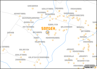
Sar Deh (Khorāsān, Iran)Sar Deh is a town in the Khorāsān region of Iran. An overview map of the region around Sar Deh is displayed below.
regional and 3d topo map of Sar Deh, Iran ::
Sar Deh airports ::
The nearest airport is ASB - Ashkhabad Ashgabat, located 195.4 km north of Sar Deh.
Nearby towns ::
Baḩrūd (0.0km east) //
Mo‘tamadīyeh (0.1km south east) //
Şebyān (1.9km east) //
şebyān (2.2km east) //
Moḩammadābād (2.6km south east) //
Eqbālīyeh (3.2km north east) //
Ḩoseynābād-e Kamāl (3.0km north east) //
Bāzūband (3.5km west) //
‘Abdolābād (3.9km north east) //
Najafābād (4.6km south west) //
Robāţ (4.3km south west) //
Ḩeşār Gowdāl (5.5km north) //
Jalālābād (4.9km east) //
Dehnow-e Khalaj (6.2km north) //
Golestān (5.2km east) //
Barghān (6.7km north) //
Mehdīābād (7.0km north) //
Bozqūchān (7.1km north) //
Do Zendeh Jān-e Kohneh (5.9km west) //
Qal‘eh Ḩasan (6.0km east) //
Ebrāhīmābād (7.2km north) //
Bozghan (7.6km north) //
Nayyerābād (6.6km west) //
Ḩeydarābād (7.3km north east) //
Amīnābād (8.0km north) //
Sa‘dābād (8.1km north east) //
Qareh Cheshmeh (7.6km north east) //
Aḩmadīyeh (7.3km north west) //
Do Zendeh Jān-e Now (7.9km north west) //
[all distances 'as the bird flies' and approximate] 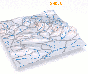 Places with similar names to Sar Deh, Iran ::
Disclaimer :: Information on this page comes without warranty of any kind |
||
|
Where is Sar Deh? Elevation and coordinates ::
Latitude (lat): 36°14'2"N Longitude (lon): 58°33'44"E
Elevation (approx.): 1128m (map arrows pan, magnifying glasses zoom) |
||
|
Visiting Sar Deh? Hotel/Accommodation ::
Book a hotel in Sar Deh Travel Guide ::
Buy a travel guide for Iran rental cars ::
car rental offers GPS waypoint ::
download a GPX waypoint (PoI) of Sar Deh for your GPS receiver
|
||