|
search place name
|
||
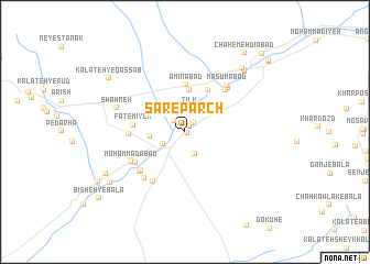
Sar-e Parch (Khorāsān, Iran)Sar-e Parch is a town in the Khorāsān region of Iran. An overview map of the region around Sar-e Parch is displayed below.
regional and 3d topo map of Sar-e Parch, Iran ::
Sar-e Parch airports ::
The nearest airport is XBJ - Birjand, located 36.5 km east of Sar-e Parch.
Nearby towns ::
Jowmīān (0.2km south east) //
Kūsheh-ye Pā'īn (0.7km north east) //
Khūsf (1.2km north east) //
Shāh Zīleh (1.4km north west) //
Kalāteh-ye Nīm Farsang (2.4km south) //
Tīlk (2.4km north) //
Sang-e Neveshteh (2.4km north) //
Jūmīān (2.2km south west) //
Bāghān (2.2km south west) //
Kūsheh-ye Bālā (3.0km north east) //
Nāşerābād (3.0km west) //
Kalāteh-ye Malek (4.3km north) //
Amīnābād (4.8km north) //
Qāsemābād (4.7km north east) //
Fāţemīyeh (4.4km west) //
Naşrābād (4.8km west) //
Moḩammadābād (5.5km north east) //
Kalāteh-ye Qar (5.7km south west) //
Fedeshk (5.4km south west) //
Kalāteh-ye Nakhlīdeh (5.3km south west) //
Ḩājjī Ḩasan (5.3km south west) //
Eshpeshkān (5.5km south west) //
Kalāteh-ye Qorbān ‘Alī Beyk (5.6km south west) //
Kalāteh-ye Qāẕī (5.4km south west) //
Taqāb (5.7km north east) //
Kalāteh-ye Mīr Loţf‘alī (5.8km south west) //
Moḩammadābād (5.5km south west) //
Ma‘şūmābād (5.9km north east) //
Shahneh (6.3km north west) //
[all distances 'as the bird flies' and approximate]  Places with similar names to Sar-e Parch, Iran :: Disclaimer :: Information on this page comes without warranty of any kind |
||
|
Where is Sar-e Parch? Elevation and coordinates ::
Latitude (lat): 32°47'42"N Longitude (lon): 58°53'44"E
Elevation (approx.): 1310m (map arrows pan, magnifying glasses zoom) |
||
|
Visiting Sar-e Parch? Hotel/Accommodation ::
Book a hotel in Sar-e Parch Travel Guide ::
Buy a travel guide for Iran rental cars ::
car rental offers GPS waypoint ::
download a GPX waypoint (PoI) of Sar-e Parch for your GPS receiver
|
||