|
search place name
|
||
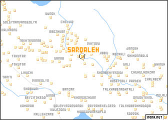
Sar Qal‘eh (Khūzestān, Iran)Sar Qal‘eh is a town in the Khūzestān region of Iran. An overview map of the region around Sar Qal‘eh is displayed below.
regional and 3d topo map of Sar Qal‘eh, Iran ::
Sar Qal‘eh airports ::
The nearest airport is QMJ - Masjed Soleiman Shahid Asyaee, located 56.1 km west of Sar Qal‘eh.
Other airports nearby include AWZ - Ahwaz (128.7 km south west), MRX - Bandar Mahshahr Mahshahr (175.5 km south west), ABD - Abadan (239.9 km south west), Nearby towns ::
Sar Qal‘eh Zīvār-e Bālā (0.3km north west) //
Pīrānshāhī (0.9km south) //
Sar Qal‘eh Zīvār-e Pā'īn (0.9km south) //
Mālmīrān (1.2km north) //
Mehrnān-e Pā'īn (1.3km north west) //
Gīlān (1.8km north east) //
Konār Sīāh (2.0km south east) //
Bar Āftāb-e ‘Olyā (2.5km west) //
Mehrnān-e Bālā (2.6km north west) //
Deh-e Kohneh (3.0km north west) //
Bar Āftāb-e Soflá (2.9km south west) //
Chāh-e Dowpowk (3.6km south) //
Rīm Tarū (3.4km north east) //
Deh Kohneh (3.8km south) //
Sar Sīāh Chāl (3.5km south west) //
Kohneh Bahrāmī (4.1km north west) //
Monjafkeh (4.1km south east) //
Lo'lo' (3.8km north west) //
Deh-e Mīrān (4.5km north) //
Seyyed Morād-e Mehdī Pūr (4.5km north) //
Āb Bīd (3.9km east) //
Tareshok (4.1km south west) //
Jowkār-e Mardom Dān (4.6km north west) //
Deh-e Ḩowz (5.0km north) //
Deh Şāleḩ (4.6km north west) //
Bard Mīl-e Almāsīhā (4.4km east) //
Deh-e Sheykh (5.0km north west) //
Deh-e Gowhar-e Almāsī (4.5km east) //
Darvīsh Sa‘īdī (5.0km south east) //
[all distances 'as the bird flies' and approximate]  Places with similar names to Sar Qal‘eh, Iran ::
Disclaimer :: Information on this page comes without warranty of any kind |
||
|
Where is Sar Qal‘eh? Elevation and coordinates ::
Latitude (lat): 32°0'57"N Longitude (lon): 49°51'49"E
Elevation (approx.): 583m (map arrows pan, magnifying glasses zoom) |
||
|
Visiting Sar Qal‘eh? Hotel/Accommodation ::
Book a hotel in Sar Qal‘eh Travel Guide ::
Buy a travel guide for Iran rental cars ::
car rental offers GPS waypoint ::
download a GPX waypoint (PoI) of Sar Qal‘eh for your GPS receiver
|
||