|
search place name
|
||
Sartanān Gīlān (Ostān-e Kermānshāh, Iran)Sartanān Gīlān is a town in the Ostān-e Kermānshāh region of Iran. An overview map of the region around Sartanān Gīlān is displayed below.
regional and 3d topo map of Sartanān Gīlān, Iran ::

Sartanān Gīlān airports ::
The nearest airport is KSH - Bakhtaran Shahid Ashrafi Esfahani, located 129.5 km east of Sartanān Gīlān.
Other airports nearby include SDG - Sanandaj (155.4 km north east), Nearby towns ::
Tūrān Shāh (2.8km south east) //
Rū'ībān-e Kūchak (3.2km north) //
Qāsemābād (3.1km east) //
Rū'ībān-e Bozorg (5.3km north) //
Jāber-e Soflá (5.1km south east) //
‘Alīābād (5.0km south east) //
Gāvmīsh Cherān (5.7km south east) //
Emām Ḩasan (6.9km north) //
Emām Ḩasan-e Bālā (7.4km north) //
Dārtūt-e Şayyādī (6.7km south east) //
Emām Ḩasan-e Soflá (7.2km north) //
Emām Ḩasan-e Vasaţī (7.6km north west) //
Poshteh Kūrak (7.5km east) //
Savār (8.2km south east) //
Gāvmakhal (8.1km south east) //
Marjān-e ‘Alīreẕāvandī (8.5km south east) //
Marjān-e Bābā Morād (8.5km south east) //
Mūderāz (8.5km south east) //
Būreh (9.1km south east) //
Qeyţūl-e Marjān (9.0km south east) //
Gomār (10.6km south east) //
[all distances 'as the bird flies' and approximate] 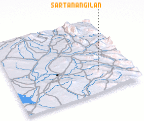 Places with similar names to Sartanān Gīlān, Iran :: Disclaimer :: Information on this page comes without warranty of any kind |
||
|
Where is Sartanān Gīlān? Elevation and coordinates ::
Latitude (lat): 34°18'18"N Longitude (lon): 45°45'7"E
Elevation (approx.): 577m (map arrows pan, magnifying glasses zoom) |
||
|
Visiting Sartanān Gīlān? Hotel/Accommodation ::
Book a hotel in Sartanān Gīlān Travel Guide ::
Buy a travel guide for Iran rental cars ::
car rental offers GPS waypoint ::
download a GPX waypoint (PoI) of Sartanān Gīlān for your GPS receiver
|
||