|
search place name
|
||
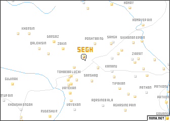
Segh (Hormozgān, Iran)Segh is a town in the Hormozgān region of Iran. An overview map of the region around Segh is displayed below.
regional and 3d topo map of Segh, Iran ::
Segh airports ::
The nearest airport is BND - Bandar Abbass Intl, located 64.1 km south of Segh.
Other airports nearby include KHS - Khasab (180.5 km south), BDH - Bandar Lengeh (206.9 km south west), Nearby towns ::
Zārū (2.6km north east) //
Rafī‘ābād (2.6km south west) //
Karamābād (3.0km south east) //
Posht Band (4.2km north east) //
Mogh Bash (4.3km south west) //
Fāryāb-e Hāshem (4.5km south) //
Tomb-e Āb (4.5km south) //
Sarshaq (4.7km south) //
Tomb-e Balūchī (4.7km south west) //
Zākīn (5.1km north west) //
Tomb-e Āsh (5.4km south west) //
Kūveh-ye Pā'īn (5.8km south west) //
Tal-e Gerdū (5.3km east) //
Kanārū (5.7km south east) //
Kūveh-ye Bālā (6.3km south west) //
Posht-e Konūn (6.3km north east) //
Faraḩābād (6.8km south east) //
Samgh (6.9km north east) //
Narīngān (6.7km east) //
Vāyekān (7.8km south) //
Dar Gaz (7.4km north west) //
Tal Sūrū (7.3km west) //
Tombū Gard (7.5km east) //
Pākestān (9.3km south) //
Ţīfakān (9.2km south east) //
[all distances 'as the bird flies' and approximate] 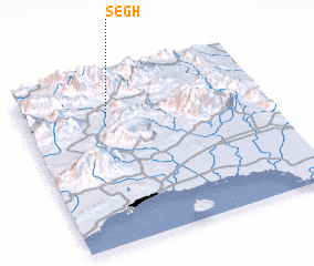 Places with similar names to Segh, Iran ::
Disclaimer :: Information on this page comes without warranty of any kind |
||
|
Where is Segh? Elevation and coordinates ::
Latitude (lat): 27°47'47"N Longitude (lon): 56°21'39"E
Elevation (approx.): 790m (map arrows pan, magnifying glasses zoom) |
||
|
Visiting Segh? Hotel/Accommodation ::
Book a hotel in Segh Travel Guide ::
Buy a travel guide for Iran rental cars ::
car rental offers GPS waypoint ::
download a GPX waypoint (PoI) of Segh for your GPS receiver
|
||