|
search place name
|
||
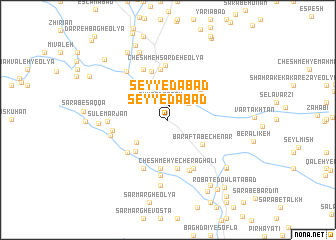
Seyyedābād (Lorestān, Iran)Seyyedābād is a town in the Lorestān region of Iran. An overview map of the region around Seyyedābād is displayed below.
regional and 3d topo map of Seyyedābād, Iran ::
Seyyedābād airports ::
The nearest airport is KSH - Bakhtaran Shahid Ashrafi Esfahani, located 123.1 km north west of Seyyedābād.
Other airports nearby include SDG - Sanandaj (205.5 km north west), QMJ - Masjed Soleiman Shahid Asyaee (211.4 km south east), Nearby towns ::
Seyyedābād (1.5km north) //
Eyvān Darreh (2.1km north) //
Kākā Reẕā-ye ‘Olyā (2.7km north east) //
Shahrak-e Kākā Reẕā (3.1km north east) //
Kākāreẕā-ye Vosţá (3.1km north east) //
Darreh-ye Jennī (3.9km south west) //
Cham Bīm Yār (4.4km north west) //
Garmābjūb (4.4km north west) //
Barāftāb-e Chenār (4.2km south east) //
Kermānjūb (4.4km north west) //
Kākāreẕā Soflá (4.5km north east) //
Hezār Manī (4.6km south west) //
Cheshmeh Şāleḩ (5.5km south) //
Shahrak-e Jadīd-e Zarrīn Choqā-ye Soflá (5.5km south) //
Cheshmeh-ye Cherāgh ‘Alī (5.5km south) //
Cheshmeh Sardeh-ye Soflá (5.7km north) //
Shabasī (5.6km north) //
Ḩeydarābād (5.2km south west) //
Cheshmeh Bīd (5.9km south) //
Manşūrābād (5.9km south) //
Raḩīmābād (5.9km south) //
Zarrīn Choghā-ye Soflá (6.0km south) //
Cheshmeh Sardeh-e ‘Olyā (6.1km north) //
Zarrīn Choghā-ye ‘Olyā (6.0km south east) //
Zarrīnchoghā-ye Vosţá (6.0km south east) //
Tang-e Ḩasan (6.2km south) //
Chūrdūneh (6.1km north) //
Shabes (6.1km north) //
Shotormāl-e ‘Olyā-ye Hemmat (5.3km west) //
[all distances 'as the bird flies' and approximate]  Places with similar names to Seyyedābād, Iran ::
Disclaimer :: Information on this page comes without warranty of any kind |
||
|
Where is Seyyedābād? Elevation and coordinates ::
Latitude (lat): 33°41'57"N Longitude (lon): 48°14'27"E
Elevation (approx.): 1652m (map arrows pan, magnifying glasses zoom) |
||
|
Visiting Seyyedābād? Hotel/Accommodation ::
Book a hotel in Seyyedābād Travel Guide ::
Buy a travel guide for Iran rental cars ::
car rental offers GPS waypoint ::
download a GPX waypoint (PoI) of Seyyedābād for your GPS receiver
|
||